


Letter from ONS's new Permanent Secretary setting out swingeing cuts to statistical programmes www.ons.gov.uk/news/stateme... (UK)
ONS pledges "quality over quantity" with key statistics prioritised www.ons.gov.uk/news/news/on...
#opendata #datapolicy
ONS pledges "quality over quantity" with key statistics prioritised www.ons.gov.uk/news/news/on...
#opendata #datapolicy

November 12, 2025 at 10:40 AM
Letter from ONS's new Permanent Secretary setting out swingeing cuts to statistical programmes www.ons.gov.uk/news/stateme... (UK)
ONS pledges "quality over quantity" with key statistics prioritised www.ons.gov.uk/news/news/on...
#opendata #datapolicy
ONS pledges "quality over quantity" with key statistics prioritised www.ons.gov.uk/news/news/on...
#opendata #datapolicy

#OpenData #Economia #OpenGov
📊 5.063.311 imprese attive in Italia 🇮🇹
📉 In calo dello 0,5% YoY
📅 Dati aggiornati al 31 ottobre 2025
🔗 Approfondisci su: opendata.marche.camcom.it
#Imprese #EUData #DatiPubblici #Eurostat #DataViz #Ateco2025
📊 5.063.311 imprese attive in Italia 🇮🇹
📉 In calo dello 0,5% YoY
📅 Dati aggiornati al 31 ottobre 2025
🔗 Approfondisci su: opendata.marche.camcom.it
#Imprese #EUData #DatiPubblici #Eurostat #DataViz #Ateco2025

Home Page - Open Data Camera di Commercio delle Marche
Opendata Italy: Business Demography, Dataviz and Statistics • Google Visualization API • JSON-stat • DCAT-AP_IT • DCAT-AP • schema.org • RDF Data Cube
opendata.marche.camcom.it
November 12, 2025 at 10:06 AM
#OpenData #Economia #OpenGov
📊 5.063.311 imprese attive in Italia 🇮🇹
📉 In calo dello 0,5% YoY
📅 Dati aggiornati al 31 ottobre 2025
🔗 Approfondisci su: opendata.marche.camcom.it
#Imprese #EUData #DatiPubblici #Eurostat #DataViz #Ateco2025
📊 5.063.311 imprese attive in Italia 🇮🇹
📉 In calo dello 0,5% YoY
📅 Dati aggiornati al 31 ottobre 2025
🔗 Approfondisci su: opendata.marche.camcom.it
#Imprese #EUData #DatiPubblici #Eurostat #DataViz #Ateco2025

📢 #Geodaten-Update: Die #Verwaltungsgebiete im Maßstab 1:5.000.000 (VG5000) sind jetzt mit Stand 01.01.2025 und 31.12.2024 verfügbar! 🗺️ Erhältlich in unserem #OpenData-Bereich. Mehr Infos: buff.ly/ph8BSRt

November 12, 2025 at 9:45 AM
📢 #Geodaten-Update: Die #Verwaltungsgebiete im Maßstab 1:5.000.000 (VG5000) sind jetzt mit Stand 01.01.2025 und 31.12.2024 verfügbar! 🗺️ Erhältlich in unserem #OpenData-Bereich. Mehr Infos: buff.ly/ph8BSRt
Analyses from the UK House of Commons Library following last month's #IMD25 release:
● Deprivation in English constituencies, 2025 commonslibrary.parliament.uk/research-bri...
● English deprivation data in 2025: What has changed? commonslibrary.parliament.uk/english-depr...
#IoD25 #opendata
● Deprivation in English constituencies, 2025 commonslibrary.parliament.uk/research-bri...
● English deprivation data in 2025: What has changed? commonslibrary.parliament.uk/english-depr...
#IoD25 #opendata
November 12, 2025 at 9:20 AM
Analyses from the UK House of Commons Library following last month's #IMD25 release:
● Deprivation in English constituencies, 2025 commonslibrary.parliament.uk/research-bri...
● English deprivation data in 2025: What has changed? commonslibrary.parliament.uk/english-depr...
#IoD25 #opendata
● Deprivation in English constituencies, 2025 commonslibrary.parliament.uk/research-bri...
● English deprivation data in 2025: What has changed? commonslibrary.parliament.uk/english-depr...
#IoD25 #opendata
🌍 Excited to share that our AI Logistic Awareness System (AILAS) is featured in WIPO’s Green Technology Book 2025!
AILAS uses #AI, #geospatial analytics & #opendata for weather-adaptive routing, improving disaster logistics & #resilience.
AILAS: heigit.org/ailas/
Book: tinyurl.com/ymuyvx8f
AILAS uses #AI, #geospatial analytics & #opendata for weather-adaptive routing, improving disaster logistics & #resilience.
AILAS: heigit.org/ailas/
Book: tinyurl.com/ymuyvx8f

November 12, 2025 at 8:32 AM
🌍 Excited to share that our AI Logistic Awareness System (AILAS) is featured in WIPO’s Green Technology Book 2025!
AILAS uses #AI, #geospatial analytics & #opendata for weather-adaptive routing, improving disaster logistics & #resilience.
AILAS: heigit.org/ailas/
Book: tinyurl.com/ymuyvx8f
AILAS uses #AI, #geospatial analytics & #opendata for weather-adaptive routing, improving disaster logistics & #resilience.
AILAS: heigit.org/ailas/
Book: tinyurl.com/ymuyvx8f
🗓️ Les événements au programme de la rentrée de datagouv cette semaine ⤵️ #LaRentreedatagouv #energie #opendata #datajournalisme #media

November 12, 2025 at 8:15 AM
🗓️ Les événements au programme de la rentrée de datagouv cette semaine ⤵️ #LaRentreedatagouv #energie #opendata #datajournalisme #media
I've updated my interactive map of Large Raised Reservoirs in England and Wales www.owenboswarva.com/blog/note-lr...
This is based on recent extracts from public registers maintained by the Environment Agency and Natural Resources Wales
#FOI #opendata #reservoirs #floodrisk
This is based on recent extracts from public registers maintained by the Environment Agency and Natural Resources Wales
#FOI #opendata #reservoirs #floodrisk

November 12, 2025 at 8:01 AM
I've updated my interactive map of Large Raised Reservoirs in England and Wales www.owenboswarva.com/blog/note-lr...
This is based on recent extracts from public registers maintained by the Environment Agency and Natural Resources Wales
#FOI #opendata #reservoirs #floodrisk
This is based on recent extracts from public registers maintained by the Environment Agency and Natural Resources Wales
#FOI #opendata #reservoirs #floodrisk

Datos abiertos de AEMET consta del #PlanRISP de AEMET, de AEMET #OpenData y #estadísticas.
#Aemetblog | Blog de la Agencia Estatal de Meteorología
aemetblog.es
@aemet.es
#Aemetblog | Blog de la Agencia Estatal de Meteorología
aemetblog.es
@aemet.es

Aemetblog
El Congreso acogió a más de 500 profesionales bajo el lema: "Bibliotecas públicas: donde la cultura se hace derecho”. Te lo contamos en #AEMETBlog
aemetblog.es
November 12, 2025 at 7:32 AM
Datos abiertos de AEMET consta del #PlanRISP de AEMET, de AEMET #OpenData y #estadísticas.
#Aemetblog | Blog de la Agencia Estatal de Meteorología
aemetblog.es
@aemet.es
#Aemetblog | Blog de la Agencia Estatal de Meteorología
aemetblog.es
@aemet.es

🗺About: #OSMGeoweek is the annual worldwide celebration of #openstreetmap that takes place in November. OSM communities host events to showcase the power of crowdsourced mapping and invite new mappers into the fold.
🌐Organize or find an event to join: osmgeoweek.org
#OpenStreetMap #opendata
🌐Organize or find an event to join: osmgeoweek.org
#OpenStreetMap #opendata
UN Mappers Mappy Hour
Learn how to map for peacekeeping missions with UN Mappers. All mappers, new and experienced, welcome!
www.eventbrite.com
November 12, 2025 at 7:18 AM
🗺About: #OSMGeoweek is the annual worldwide celebration of #openstreetmap that takes place in November. OSM communities host events to showcase the power of crowdsourced mapping and invite new mappers into the fold.
🌐Organize or find an event to join: osmgeoweek.org
#OpenStreetMap #opendata
🌐Organize or find an event to join: osmgeoweek.org
#OpenStreetMap #opendata
We are mapping during #OSMGeoweek2025! 🎉
Join our November UN Mappers #MappyHour and celebrate #OpenStreetMap Geography Awareness Week with us! 💙
📅 21 November
⏱️ 10:00 UTC
📌 Registration: www.eventbrite.com/e/un-mappers...
#UNMaps #OpenStreetMap #opendata #volunteering #osmgeoweek #UNvolunteers
Join our November UN Mappers #MappyHour and celebrate #OpenStreetMap Geography Awareness Week with us! 💙
📅 21 November
⏱️ 10:00 UTC
📌 Registration: www.eventbrite.com/e/un-mappers...
#UNMaps #OpenStreetMap #opendata #volunteering #osmgeoweek #UNvolunteers

November 12, 2025 at 7:15 AM
We are mapping during #OSMGeoweek2025! 🎉
Join our November UN Mappers #MappyHour and celebrate #OpenStreetMap Geography Awareness Week with us! 💙
📅 21 November
⏱️ 10:00 UTC
📌 Registration: www.eventbrite.com/e/un-mappers...
#UNMaps #OpenStreetMap #opendata #volunteering #osmgeoweek #UNvolunteers
Join our November UN Mappers #MappyHour and celebrate #OpenStreetMap Geography Awareness Week with us! 💙
📅 21 November
⏱️ 10:00 UTC
📌 Registration: www.eventbrite.com/e/un-mappers...
#UNMaps #OpenStreetMap #opendata #volunteering #osmgeoweek #UNvolunteers
New municipality live!
Beaver County: beaver-county.ut.civic.band
1969 pages going back to 2010
#BeaverCounty #Utah #OpenData
Beaver County: beaver-county.ut.civic.band
1969 pages going back to 2010
#BeaverCounty #Utah #OpenData
November 12, 2025 at 1:39 AM
New municipality live!
Beaver County: beaver-county.ut.civic.band
1969 pages going back to 2010
#BeaverCounty #Utah #OpenData
Beaver County: beaver-county.ut.civic.band
1969 pages going back to 2010
#BeaverCounty #Utah #OpenData
New municipality live!
Mayfield Heights: mayfieldheights.oh.civic.band
4480 pages going back to 2013
#MayfieldHeights #Ohio #OpenData
Mayfield Heights: mayfieldheights.oh.civic.band
4480 pages going back to 2013
#MayfieldHeights #Ohio #OpenData
November 12, 2025 at 1:35 AM
New municipality live!
Mayfield Heights: mayfieldheights.oh.civic.band
4480 pages going back to 2013
#MayfieldHeights #Ohio #OpenData
Mayfield Heights: mayfieldheights.oh.civic.band
4480 pages going back to 2013
#MayfieldHeights #Ohio #OpenData
DOAJ Managing Editor @Alejandra Manco Vega will be attending the The 4th Sustainable Publishing Forum
🔹13-14 November
🔹Barcelona, Spain
Event details: sciforum.net/event/SPF202...
#OpenScience #OpenAccess #OpenData #AI #GenAI #ScholarlyPublishing
🔹13-14 November
🔹Barcelona, Spain
Event details: sciforum.net/event/SPF202...
#OpenScience #OpenAccess #OpenData #AI #GenAI #ScholarlyPublishing

November 11, 2025 at 9:58 PM
DOAJ Managing Editor @Alejandra Manco Vega will be attending the The 4th Sustainable Publishing Forum
🔹13-14 November
🔹Barcelona, Spain
Event details: sciforum.net/event/SPF202...
#OpenScience #OpenAccess #OpenData #AI #GenAI #ScholarlyPublishing
🔹13-14 November
🔹Barcelona, Spain
Event details: sciforum.net/event/SPF202...
#OpenScience #OpenAccess #OpenData #AI #GenAI #ScholarlyPublishing
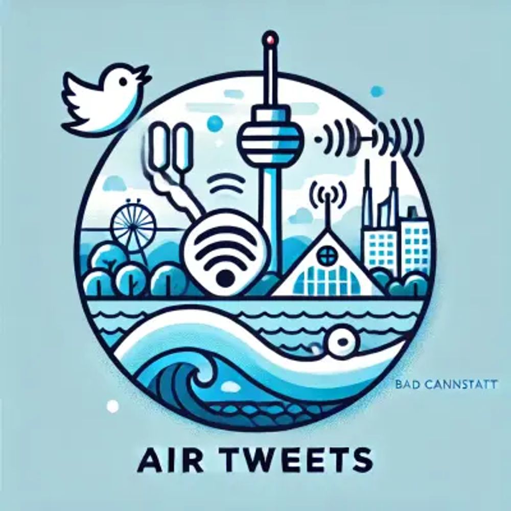
DAILY AIR QUALITY UPDATE
#Feinstaub in #Cannstatt / #Stuttgart (11.11.2025 20:06 CET)
PM10: 13.8 µg/m³
PM2.5: 9.6 µg/m³
Details: #15/48.8040/9.228040/9.2280" class="hover:underline text-blue-600 dark:text-sky-400 no-card-link" target="_blank" rel="noopener" data-link="bsky">https://maps.sensor.community/#15/48.8040/9.2280
#Luftverschmutzung #Particulatematter #Opendata #Civictech #Airrohr #Airpollution #Airquality

November 11, 2025 at 7:06 PM
DAILY AIR QUALITY UPDATE
#Feinstaub in #Cannstatt / #Stuttgart (11.11.2025 20:06 CET)
PM10: 13.8 µg/m³
PM2.5: 9.6 µg/m³
Details: #15/48.8040/9.228040/9.2280" class="hover:underline text-blue-600 dark:text-sky-400 no-card-link" target="_blank" rel="noopener" data-link="bsky">https://maps.sensor.community/#15/48.8040/9.2280
#Luftverschmutzung #Particulatematter #Opendata #Civictech #Airrohr #Airpollution #Airquality

#MEUH3 avance bien : différentes sources de données assez légères pour être utilisées comme test m'ont permis de résoudre plusieurs bugs, comme lorsqu'une ligne circulaire utilise le même point d'arrêt pour son départ et son arrivée. Merci Tulle ! #Opendata #OpenTransport #GTFS (@newem.bsky.social)

November 11, 2025 at 6:58 PM
#MEUH3 avance bien : différentes sources de données assez légères pour être utilisées comme test m'ont permis de résoudre plusieurs bugs, comme lorsqu'une ligne circulaire utilise le même point d'arrêt pour son départ et son arrivée. Merci Tulle ! #Opendata #OpenTransport #GTFS (@newem.bsky.social)

New blog post 💻
Discover how to make your data available for others to reuse which can increase the validity, reproducibility, and impact of your research.
🔗 Read now: spr.ly/60017pcdJ
#OpenData #OpenResearch
Discover how to make your data available for others to reuse which can increase the validity, reproducibility, and impact of your research.
🔗 Read now: spr.ly/60017pcdJ
#OpenData #OpenResearch

November 11, 2025 at 6:00 PM
New blog post 💻
Discover how to make your data available for others to reuse which can increase the validity, reproducibility, and impact of your research.
🔗 Read now: spr.ly/60017pcdJ
#OpenData #OpenResearch
Discover how to make your data available for others to reuse which can increase the validity, reproducibility, and impact of your research.
🔗 Read now: spr.ly/60017pcdJ
#OpenData #OpenResearch

Wikimedia Polska strengthens the link between open cultural data and art research — from the Open Data in Art Research seminar in Vienna to the Digital Culture Forum in Gdańsk.
Focus: FAIR data, ethics, and responsible use of open cultural resources in the creative sector.
#opendata […]
Focus: FAIR data, ethics, and responsible use of open cultural resources in the creative sector.
#opendata […]
Original post on det.social
det.social
November 11, 2025 at 5:40 PM
Wikimedia Polska strengthens the link between open cultural data and art research — from the Open Data in Art Research seminar in Vienna to the Digital Culture Forum in Gdańsk.
Focus: FAIR data, ethics, and responsible use of open cultural resources in the creative sector.
#opendata […]
Focus: FAIR data, ethics, and responsible use of open cultural resources in the creative sector.
#opendata […]

More Coverage, New Partners, and Upcoming Talks by the #MapYourGrid Team (including us).
The project’s aim is to increase #OpenStreetMap coverage of the electricity grid while maintaining high data quality.
Huge thanks to everyone!
mapyourgrid.org/
#OpenSource #OpenData #EnergyPlanning
The project’s aim is to increase #OpenStreetMap coverage of the electricity grid while maintaining high data quality.
Huge thanks to everyone!
mapyourgrid.org/
#OpenSource #OpenData #EnergyPlanning

November 11, 2025 at 3:50 PM
More Coverage, New Partners, and Upcoming Talks by the #MapYourGrid Team (including us).
The project’s aim is to increase #OpenStreetMap coverage of the electricity grid while maintaining high data quality.
Huge thanks to everyone!
mapyourgrid.org/
#OpenSource #OpenData #EnergyPlanning
The project’s aim is to increase #OpenStreetMap coverage of the electricity grid while maintaining high data quality.
Huge thanks to everyone!
mapyourgrid.org/
#OpenSource #OpenData #EnergyPlanning

Linked Open Data in der Praxis:
Beim Barcamp zu Linked Open Data in 🌇 #Bielefeld am 27.11.
- ein offenes Forum für 🏛️Verwaltung, Zivilgesellschaft und
⚙️Technikinteressierte um gemeinsam Erfahrungen mit #OpenData auszutauschen & neue Ideen zu entwickeln.
Mehr Infos:👇
open.nrw/barcamp-link...
Beim Barcamp zu Linked Open Data in 🌇 #Bielefeld am 27.11.
- ein offenes Forum für 🏛️Verwaltung, Zivilgesellschaft und
⚙️Technikinteressierte um gemeinsam Erfahrungen mit #OpenData auszutauschen & neue Ideen zu entwickeln.
Mehr Infos:👇
open.nrw/barcamp-link...
Barcamp: Linked Open Data
Code für Bielefeld, Open Knowledge Foundation Deutschland, sparkup und FörderFunke laden zum Barcamp rund um das Thema Linked Open Data ein. Es soll gemeinsam darüber gesprochen werden, wie in Bielefe...
open.nrw
November 11, 2025 at 11:30 AM
Linked Open Data in der Praxis:
Beim Barcamp zu Linked Open Data in 🌇 #Bielefeld am 27.11.
- ein offenes Forum für 🏛️Verwaltung, Zivilgesellschaft und
⚙️Technikinteressierte um gemeinsam Erfahrungen mit #OpenData auszutauschen & neue Ideen zu entwickeln.
Mehr Infos:👇
open.nrw/barcamp-link...
Beim Barcamp zu Linked Open Data in 🌇 #Bielefeld am 27.11.
- ein offenes Forum für 🏛️Verwaltung, Zivilgesellschaft und
⚙️Technikinteressierte um gemeinsam Erfahrungen mit #OpenData auszutauschen & neue Ideen zu entwickeln.
Mehr Infos:👇
open.nrw/barcamp-link...

FOSSGIS 2026: Community-Voting gestartet / Community voting has started geoobserver.de/2025/11/11/f... #fossgis #fossgis2026 #gistribe #gischat #OSGeo #spatial #geospatial #opensource #opendata #osm #openstreetmap #gis #geo #geoObserver pls RT

November 11, 2025 at 10:43 AM
FOSSGIS 2026: Community-Voting gestartet / Community voting has started geoobserver.de/2025/11/11/f... #fossgis #fossgis2026 #gistribe #gischat #OSGeo #spatial #geospatial #opensource #opendata #osm #openstreetmap #gis #geo #geoObserver pls RT


November 11, 2025 at 9:40 AM

This is so cool, thank you! Regarding the irrelevant map sections, what map did you use? I just downloaded the "Election Precincts" map from the MN Gov OpenData portal and it only includes Minneapolis Ward-Precincts, if that's helpful. Here's what it looked like (w/your data):

November 10, 2025 at 11:17 PM
This is so cool, thank you! Regarding the irrelevant map sections, what map did you use? I just downloaded the "Election Precincts" map from the MN Gov OpenData portal and it only includes Minneapolis Ward-Precincts, if that's helpful. Here's what it looked like (w/your data):

🌬️ Entre 2016 et 2023, les concentrations de dioxyde d’azote (NO₂) ont nettement baissé à Bordeaux, surtout le long de la rocade et des grands axes.
Cartes issues de la modélisation annuelle.
Source : Atmo Nouvelle-Aquitaine.
#30DayMapChallenge #Air #Bordeaux #OpenData
Cartes issues de la modélisation annuelle.
Source : Atmo Nouvelle-Aquitaine.
#30DayMapChallenge #Air #Bordeaux #OpenData

November 10, 2025 at 11:06 PM
🌬️ Entre 2016 et 2023, les concentrations de dioxyde d’azote (NO₂) ont nettement baissé à Bordeaux, surtout le long de la rocade et des grands axes.
Cartes issues de la modélisation annuelle.
Source : Atmo Nouvelle-Aquitaine.
#30DayMapChallenge #Air #Bordeaux #OpenData
Cartes issues de la modélisation annuelle.
Source : Atmo Nouvelle-Aquitaine.
#30DayMapChallenge #Air #Bordeaux #OpenData
Job – Director of Technology at the Open Data Institute @odihq.bsky.social in London theodi.livevacancies.co.uk#/job/details...
#opendata -adjacent
(I mean, I guess. It's still in the name anyway)
#opendata -adjacent
(I mean, I guess. It's still in the name anyway)

November 10, 2025 at 7:45 PM
Job – Director of Technology at the Open Data Institute @odihq.bsky.social in London theodi.livevacancies.co.uk#/job/details...
#opendata -adjacent
(I mean, I guess. It's still in the name anyway)
#opendata -adjacent
(I mean, I guess. It's still in the name anyway)
DAILY AIR QUALITY UPDATE
#Feinstaub in #Cannstatt / #Stuttgart (10.11.2025 20:06 CET)
PM10: 13.9 µg/m³
PM2.5: 10.3 µg/m³
Details: #15/48.8040/9.228040/9.2280" class="hover:underline text-blue-600 dark:text-sky-400 no-card-link" target="_blank" rel="noopener" data-link="bsky">https://maps.sensor.community/#15/48.8040/9.2280
#Luftverschmutzung #Particulatematter #Opendata #Civictech #Airrohr #Airpollution #Airquality

November 10, 2025 at 7:06 PM
DAILY AIR QUALITY UPDATE
#Feinstaub in #Cannstatt / #Stuttgart (10.11.2025 20:06 CET)
PM10: 13.9 µg/m³
PM2.5: 10.3 µg/m³
Details: #15/48.8040/9.228040/9.2280" class="hover:underline text-blue-600 dark:text-sky-400 no-card-link" target="_blank" rel="noopener" data-link="bsky">https://maps.sensor.community/#15/48.8040/9.2280
#Luftverschmutzung #Particulatematter #Opendata #Civictech #Airrohr #Airpollution #Airquality