


Robin Wilson
@robintw.bsky.social
Freelance geospatial software engineer and data scientist. PhD in satellite imaging.
Blogger (https://blog.rtwilson.com/) author of the FreeGISData site (https://freegisdata.rtwilson.com/) & the British Placename Mapper (https://placenames.rtwilson.com/)
Blogger (https://blog.rtwilson.com/) author of the FreeGISData site (https://freegisdata.rtwilson.com/) & the British Placename Mapper (https://placenames.rtwilson.com/)
Yes though I was brought up bringing it to the boil on the hob. Only started using a kettle once I met my wife
November 3, 2025 at 5:52 PM
Yes though I was brought up bringing it to the boil on the hob. Only started using a kettle once I met my wife
This is one of the weirder comments that I've made on BlueSky, but...we have that Z80 chopping board!
September 7, 2025 at 4:43 PM
This is one of the weirder comments that I've made on BlueSky, but...we have that Z80 chopping board!
(Partially prompted by reading Exploding the Phone, a good book about phone phreaking in the US, and realising that from that and various other similar books - eg. Kevin Mitnick's - I know significantly more about the US phone network than the network in my own country!)
August 23, 2025 at 5:34 PM
(Partially prompted by reading Exploding the Phone, a good book about phone phreaking in the US, and realising that from that and various other similar books - eg. Kevin Mitnick's - I know significantly more about the US phone network than the network in my own country!)
I'm also quite surprised that I hadn't come across this previously, having been working in geospatial for quite a long time. Every day is a day for learning!
August 7, 2025 at 3:23 PM
I'm also quite surprised that I hadn't come across this previously, having been working in geospatial for quite a long time. Every day is a day for learning!
Gabi, a MSc student I've been supervising, will also be giving a talk about developing a system to look at secondary flooding impacts, specifically loss of power and loss of road access, on businesses in the UK. She'll be covering use of pgRouting, complex PostGIS SQL queries etc. #foss4guk
August 5, 2025 at 6:33 PM
Gabi, a MSc student I've been supervising, will also be giving a talk about developing a system to look at secondary flooding impacts, specifically loss of power and loss of road access, on businesses in the UK. She'll be covering use of pgRouting, complex PostGIS SQL queries etc. #foss4guk
I might have to steal one of their section headers as my tagline, as I tend to refer to myself as a geospatial software engineer: 'Geospatial software engineering as its own weirdo niche'
#gis
#gis
August 4, 2025 at 8:57 PM
I might have to steal one of their section headers as my tagline, as I tend to refer to myself as a geospatial software engineer: 'Geospatial software engineering as its own weirdo niche'
#gis
#gis
I don't normally write long threads, but was suddenly inspired. Hope that helps @ajgwords.bsky.social - I'll be attending FOSS4G UK (and presenting myself), so hopefully I'll be able to hear the talk!
August 4, 2025 at 1:23 PM
I don't normally write long threads, but was suddenly inspired. Hope that helps @ajgwords.bsky.social - I'll be attending FOSS4G UK (and presenting myself), so hopefully I'll be able to hear the talk!
It needs to have changed a lot from my days as an undergraduate (~20 years ago - ugh!), but I suspect it either hasn't changed that much, or the sort of things you can do in an undergrad practical session don't let you explore what is *really* done in RS any more.
August 4, 2025 at 1:23 PM
It needs to have changed a lot from my days as an undergraduate (~20 years ago - ugh!), but I suspect it either hasn't changed that much, or the sort of things you can do in an undergrad practical session don't let you explore what is *really* done in RS any more.
now with cloud-based systems, STAC and so on. I'm not sure how we should deal with this as a community, and I'm not sure how modern methods will 'trickle down' to non-code based environments. Like, what do you do in an undergrad RS practical session these days? 8/n
August 4, 2025 at 1:22 PM
now with cloud-based systems, STAC and so on. I'm not sure how we should deal with this as a community, and I'm not sure how modern methods will 'trickle down' to non-code based environments. Like, what do you do in an undergrad RS practical session these days? 8/n
4) There's a big gulf between what is possible with remote sensing if you can write code, and what is possible if you can't. That's fine for me - I can write code and enjoy doing so - but not everyone can or wants to, and that limits what you can do hugely. Potentially that applies even more 7/n
August 4, 2025 at 1:21 PM
4) There's a big gulf between what is possible with remote sensing if you can write code, and what is possible if you can't. That's fine for me - I can write code and enjoy doing so - but not everyone can or wants to, and that limits what you can do hugely. Potentially that applies even more 7/n
3) Practical remote sensing is often taught poorly, and often taught using inappropriate software. It's a long time since I've taught remote sensing at uni level, but back then and still now I keep coming across massively silly ways of teaching you how to actually do stuff with RS data 6/n
August 4, 2025 at 1:20 PM
3) Practical remote sensing is often taught poorly, and often taught using inappropriate software. It's a long time since I've taught remote sensing at uni level, but back then and still now I keep coming across massively silly ways of teaching you how to actually do stuff with RS data 6/n
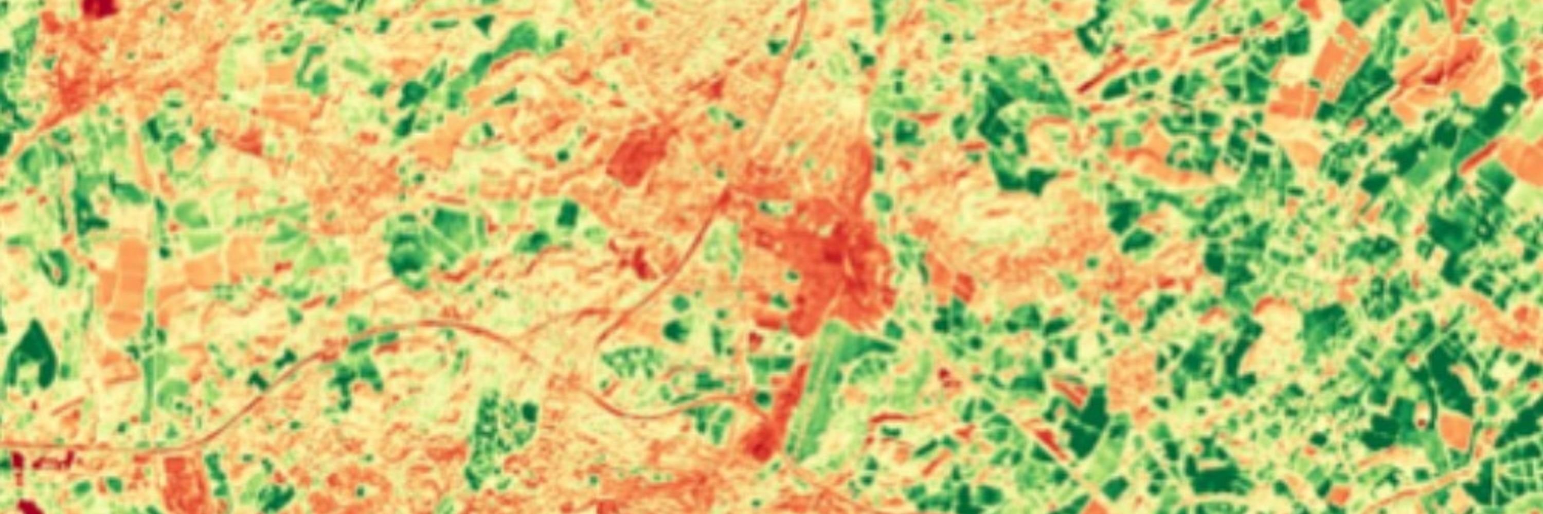
2) Loads of methods are developed using very high resolution data which can be a problem because the data is *really* expensive (sometimes you can get it free in academia), making those methods too expensive to use in the real world. Often high-res data isn't actually needed - it's 'too high' 5/n
August 4, 2025 at 1:19 PM
2) Loads of methods are developed using very high resolution data which can be a problem because the data is *really* expensive (sometimes you can get it free in academia), making those methods too expensive to use in the real world. Often high-res data isn't actually needed - it's 'too high' 5/n
much more that can be done with remote sensing than that.
That's my biggest bugbear, others are:
1) Far fewer people care about calibration and atmospheric correction now, as they don't normally need to worry about it. That's mostly ok, but *someone* needs to worry about it or it breaks down 4/n
That's my biggest bugbear, others are:
1) Far fewer people care about calibration and atmospheric correction now, as they don't normally need to worry about it. That's mostly ok, but *someone* needs to worry about it or it breaks down 4/n
August 4, 2025 at 1:17 PM
much more that can be done with remote sensing than that.
That's my biggest bugbear, others are:
1) Far fewer people care about calibration and atmospheric correction now, as they don't normally need to worry about it. That's mostly ok, but *someone* needs to worry about it or it breaks down 4/n
That's my biggest bugbear, others are:
1) Far fewer people care about calibration and atmospheric correction now, as they don't normally need to worry about it. That's mostly ok, but *someone* needs to worry about it or it breaks down 4/n