


OpenTopography
@opentopography.org
Open access to high-resolution, Earth science-oriented topography data, and related tools & resources. US National Science Foundation supported. #lidar https://www.opentopography.org
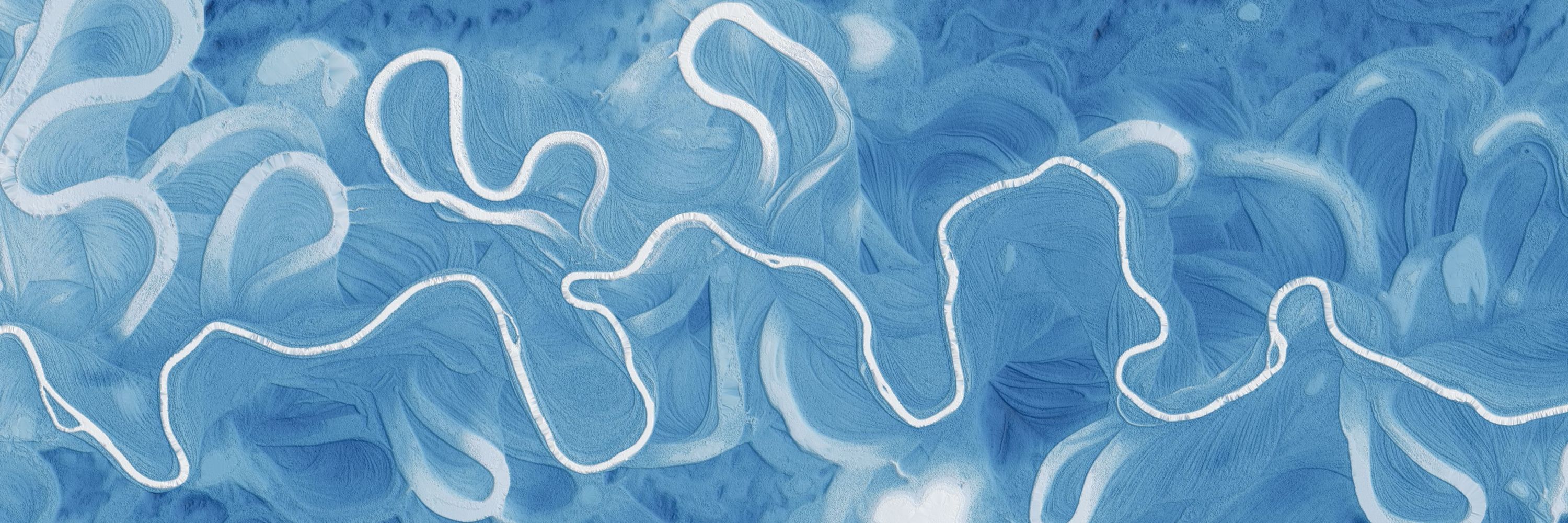
For the last several decades, scientists have been developing a way to make our maps more reliable with point cloud data collected by lidar. Lidar is an accurate method that helps scientists to map cities, landscapes, and places that were previously difficult or dangerous to access.
November 10, 2025 at 5:26 PM
For the last several decades, scientists have been developing a way to make our maps more reliable with point cloud data collected by lidar. Lidar is an accurate method that helps scientists to map cities, landscapes, and places that were previously difficult or dangerous to access.
Coastlines in Crisis
Coastal areas like the Outer Banks of North Carolina are shrinking. What can we learn and see from lidar data?
Coastal areas like the Outer Banks of North Carolina are shrinking. What can we learn and see from lidar data?
October 1, 2025 at 5:19 PM
Coastlines in Crisis
Coastal areas like the Outer Banks of North Carolina are shrinking. What can we learn and see from lidar data?
Coastal areas like the Outer Banks of North Carolina are shrinking. What can we learn and see from lidar data?
The stunning sandstone peaks of the Zhangjiajie National Forest Park in China inspired the floating mountains in the movie Avatar, but how did the real-life versions form?
September 11, 2025 at 6:27 PM
The stunning sandstone peaks of the Zhangjiajie National Forest Park in China inspired the floating mountains in the movie Avatar, but how did the real-life versions form?
The Martian Mega-Volcano
The tallest volcano on Earth, Hawaii's Mauna Kea, pales in comparison to Olympus Mons on Mars, the largest volcano in the solar system. See what we can learn by studying the topography of planetary bodies.
The tallest volcano on Earth, Hawaii's Mauna Kea, pales in comparison to Olympus Mons on Mars, the largest volcano in the solar system. See what we can learn by studying the topography of planetary bodies.
August 18, 2025 at 6:57 PM
The Martian Mega-Volcano
The tallest volcano on Earth, Hawaii's Mauna Kea, pales in comparison to Olympus Mons on Mars, the largest volcano in the solar system. See what we can learn by studying the topography of planetary bodies.
The tallest volcano on Earth, Hawaii's Mauna Kea, pales in comparison to Olympus Mons on Mars, the largest volcano in the solar system. See what we can learn by studying the topography of planetary bodies.
How do you end up with desert dunes next to a wetland? The Potholes Reservoir explained.
August 6, 2025 at 4:04 PM
How do you end up with desert dunes next to a wetland? The Potholes Reservoir explained.
The Mystery of the Missoula Megafloods
What can we learn from the topography of the Pacific Northwest?
What can we learn from the topography of the Pacific Northwest?
August 4, 2025 at 6:11 PM
The Mystery of the Missoula Megafloods
What can we learn from the topography of the Pacific Northwest?
What can we learn from the topography of the Pacific Northwest?
How did Devils Tower form?
July 28, 2025 at 5:58 PM
How did Devils Tower form?