


Mike Slifer
@mikesliferwx.bsky.social
Meteorologist with WFSB in Connecticut. AMS CBM #904
Reposted by Mike Slifer

Multi-panel view of the last few days of Hurricane Melissa:
↖️ GOES-19 infrared brightness temp
↗️ GOES-19 visible satellite
↙️ Hurricane hunter planes & flight paths
↘️ Recon-derived flight level wind swath
⬇️ Estimated minimum pressure from recon dropsondes
↖️ GOES-19 infrared brightness temp
↗️ GOES-19 visible satellite
↙️ Hurricane hunter planes & flight paths
↘️ Recon-derived flight level wind swath
⬇️ Estimated minimum pressure from recon dropsondes
October 29, 2025 at 10:14 PM
Multi-panel view of the last few days of Hurricane Melissa:
↖️ GOES-19 infrared brightness temp
↗️ GOES-19 visible satellite
↙️ Hurricane hunter planes & flight paths
↘️ Recon-derived flight level wind swath
⬇️ Estimated minimum pressure from recon dropsondes
↖️ GOES-19 infrared brightness temp
↗️ GOES-19 visible satellite
↙️ Hurricane hunter planes & flight paths
↘️ Recon-derived flight level wind swath
⬇️ Estimated minimum pressure from recon dropsondes
A few rounds of storms tomorrow. Both commutes will be affected along with outdoor plans. Poor drainage flooding and strong storms are possible, an isolated tornado cannot be ruled out #CTwx #Connecticut

September 24, 2025 at 9:34 PM
A few rounds of storms tomorrow. Both commutes will be affected along with outdoor plans. Poor drainage flooding and strong storms are possible, an isolated tornado cannot be ruled out #CTwx #Connecticut
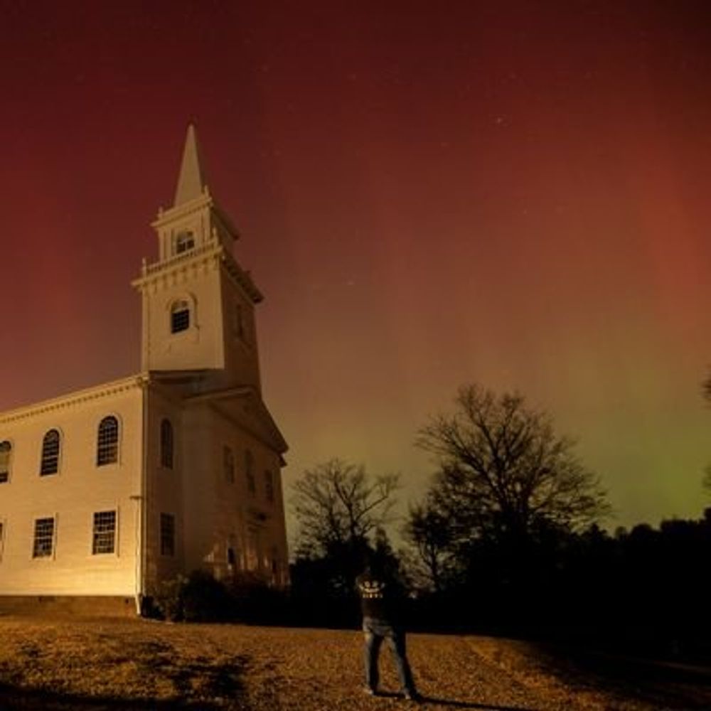
Welcomed rain this week could also re-energize some of the waterfalls, at least temporarily. Might make for some good foliage pics in areas that are turning!
September 24, 2025 at 12:33 AM
Welcomed rain this week could also re-energize some of the waterfalls, at least temporarily. Might make for some good foliage pics in areas that are turning!
Outflow boundary season
July 1, 2025 at 10:21 PM
Outflow boundary season
FIRST ALERT WEATHER DAY SATURDAY! Parts of CT are already in a level 2 risk for severe weather. Strong wind gusts and hail will be possible under the strongest cells, while any storm will produce downpours and lightning


May 15, 2025 at 8:20 PM
FIRST ALERT WEATHER DAY SATURDAY! Parts of CT are already in a level 2 risk for severe weather. Strong wind gusts and hail will be possible under the strongest cells, while any storm will produce downpours and lightning
Happy Winnie Wednesday


May 14, 2025 at 10:13 PM
Happy Winnie Wednesday
Dinner break entertainment

May 12, 2025 at 2:37 AM
Dinner break entertainment
Another day, another career fair. The Wesleyan one is always great since so many local high school students get to attend

April 24, 2025 at 10:33 PM
Another day, another career fair. The Wesleyan one is always great since so many local high school students get to attend
Reposted by Mike Slifer
Evening Eagle. This Eagle was kind enough to confirm that there were, in fact, fish in the river even though I had been fishing for some time with no luck. He made it look easy. #birds #ctnaturefans #photography


April 21, 2025 at 9:52 PM
Evening Eagle. This Eagle was kind enough to confirm that there were, in fact, fish in the river even though I had been fishing for some time with no luck. He made it look easy. #birds #ctnaturefans #photography
More snow early tomorrow followed up by a gray, chilly, raw day. Not ideal if you wanted to hang out outdoors. Sunday looks a little better!


April 11, 2025 at 8:48 PM
More snow early tomorrow followed up by a gray, chilly, raw day. Not ideal if you wanted to hang out outdoors. Sunday looks a little better!
Snow tonight with accumulation possible in the high elevations of CT. We do it again again late tomorrow night into Saturday morning, which is another First Alert Weather Day! Very chilly and gloomy to begin the weekend


April 10, 2025 at 9:15 PM
Snow tonight with accumulation possible in the high elevations of CT. We do it again again late tomorrow night into Saturday morning, which is another First Alert Weather Day! Very chilly and gloomy to begin the weekend
The most Aprily April pattern for New England moving forward
April 9, 2025 at 8:06 PM
The most Aprily April pattern for New England moving forward
What a tough weekend forecast in New England
March 25, 2025 at 8:53 PM
What a tough weekend forecast in New England


Another messy weekend… First Alert Weather Days both Saturday and Sunday as snow gives way to an icy mix. Cold & wind will bring wind chill values near zero at times early next week

February 13, 2025 at 10:52 PM
Another messy weekend… First Alert Weather Days both Saturday and Sunday as snow gives way to an icy mix. Cold & wind will bring wind chill values near zero at times early next week
Snow is back this weekend. Up to 10” possible in parts of CT away from the Sound. We first alerted you to this earlier in the week — stick with us as the storm moves through


February 6, 2025 at 11:31 PM
Snow is back this weekend. Up to 10” possible in parts of CT away from the Sound. We first alerted you to this earlier in the week — stick with us as the storm moves through
Sleet pings, freezing rain clings resulting in scenes like this. A solid layer of ice building up on my car in central CT as freezing rain/drizzle continues

February 6, 2025 at 5:43 PM
Sleet pings, freezing rain clings resulting in scenes like this. A solid layer of ice building up on my car in central CT as freezing rain/drizzle continues
Watching the Connecticut episode of Aerial America. Again. And still learning new facts about my state!
February 2, 2025 at 5:24 AM
Watching the Connecticut episode of Aerial America. Again. And still learning new facts about my state!
We began 2025 and January with a round of rain and we will end it the same. Still, January will end up being much drier than average
January 30, 2025 at 10:47 PM
We began 2025 and January with a round of rain and we will end it the same. Still, January will end up being much drier than average
Reposted by Mike Slifer
It's not often that a METAR observation records thundersnow -- it's even less often that this happens *twice*!

January 30, 2025 at 1:41 AM
It's not often that a METAR observation records thundersnow -- it's even less often that this happens *twice*!
Thunder snow with the squall in North Adams, MA!

January 29, 2025 at 5:43 PM
Thunder snow with the squall in North Adams, MA!
From the seismometer in Westport, CT

January 27, 2025 at 3:55 PM
From the seismometer in Westport, CT
Powder Ridge fun yesterday afternoon

January 26, 2025 at 2:46 PM
Powder Ridge fun yesterday afternoon

