


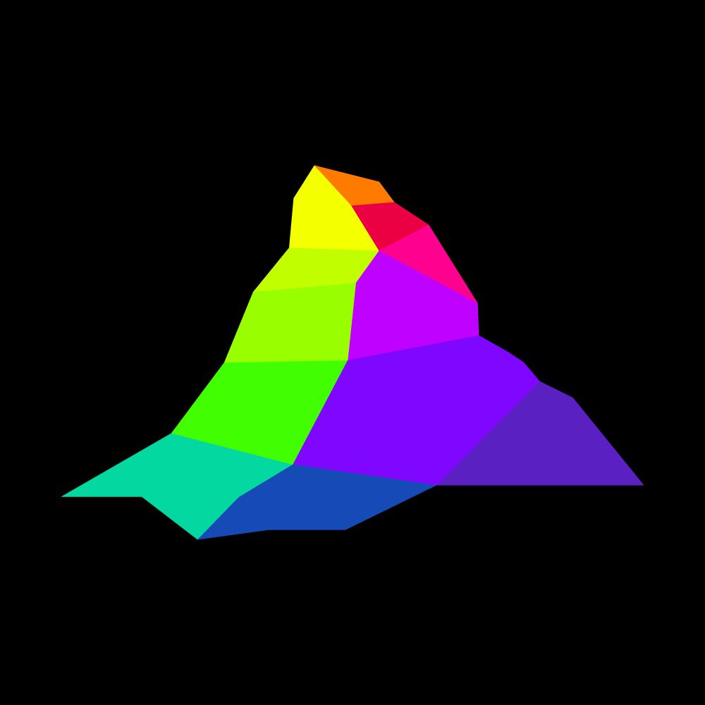
Mapterhorn
@mapterhorn.com
Public terrain tiles for interactive web map visualizations
https://mapterhorn.com
https://github.com/mapterhorn
https://mapterhorn.com
https://github.com/mapterhorn
Mapterhorn v0.0.4 ships high-resolution terrain data for Belgium, Czech Republic, Denmark, Estonia, Finland, France, Germany, Italy, Latvia, Luxembourg, Romania, Slovakia, Slovenia, and Spain.
Explore the map at mapterhorn.com/viewer/#map=...
Explore the map at mapterhorn.com/viewer/#map=...
October 20, 2025 at 8:27 AM
Mapterhorn v0.0.4 ships high-resolution terrain data for Belgium, Czech Republic, Denmark, Estonia, Finland, France, Germany, Italy, Latvia, Luxembourg, Romania, Slovakia, Slovenia, and Spain.
Explore the map at mapterhorn.com/viewer/#map=...
Explore the map at mapterhorn.com/viewer/#map=...
Version 0.0.3 brings high-resolution data for Austria. Country-wide 10 m data is used, on top of which higher resolution data was layered: 5 m for Burgenland, 1 m or better for Salzburg, Oberösterreich, and Kärnten.
Enjoy the Austria data!
github.com/mapterhorn/m...
Enjoy the Austria data!
github.com/mapterhorn/m...

September 5, 2025 at 7:23 AM
Version 0.0.3 brings high-resolution data for Austria. Country-wide 10 m data is used, on top of which higher resolution data was layered: 5 m for Burgenland, 1 m or better for Salzburg, Oberösterreich, and Kärnten.
Enjoy the Austria data!
github.com/mapterhorn/m...
Enjoy the Austria data!
github.com/mapterhorn/m...
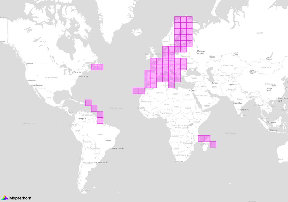
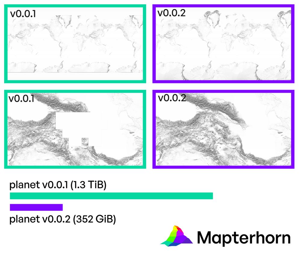
Mapterhorn v0.0.2 ships smaller tiles that are optimized for size while keeping the same visual quality, missing data in Caucasus and polar regions were added, and you can now use the pmtiles cli tool to make small area extracts.
mapterhorn.com
mapterhorn.com
August 20, 2025 at 11:24 AM
Mapterhorn v0.0.2 ships smaller tiles that are optimized for size while keeping the same visual quality, missing data in Caucasus and polar regions were added, and you can now use the pmtiles cli tool to make small area extracts.
mapterhorn.com
mapterhorn.com