


Kalain Hosein 🇹🇹
@kalain.bsky.social
Climate Change Consultant at CNC3TV & The T&T Guardian • Founder of TTWeatherCenter • Current: Columbia, Former TAMU
Reposted by Kalain Hosein 🇹🇹
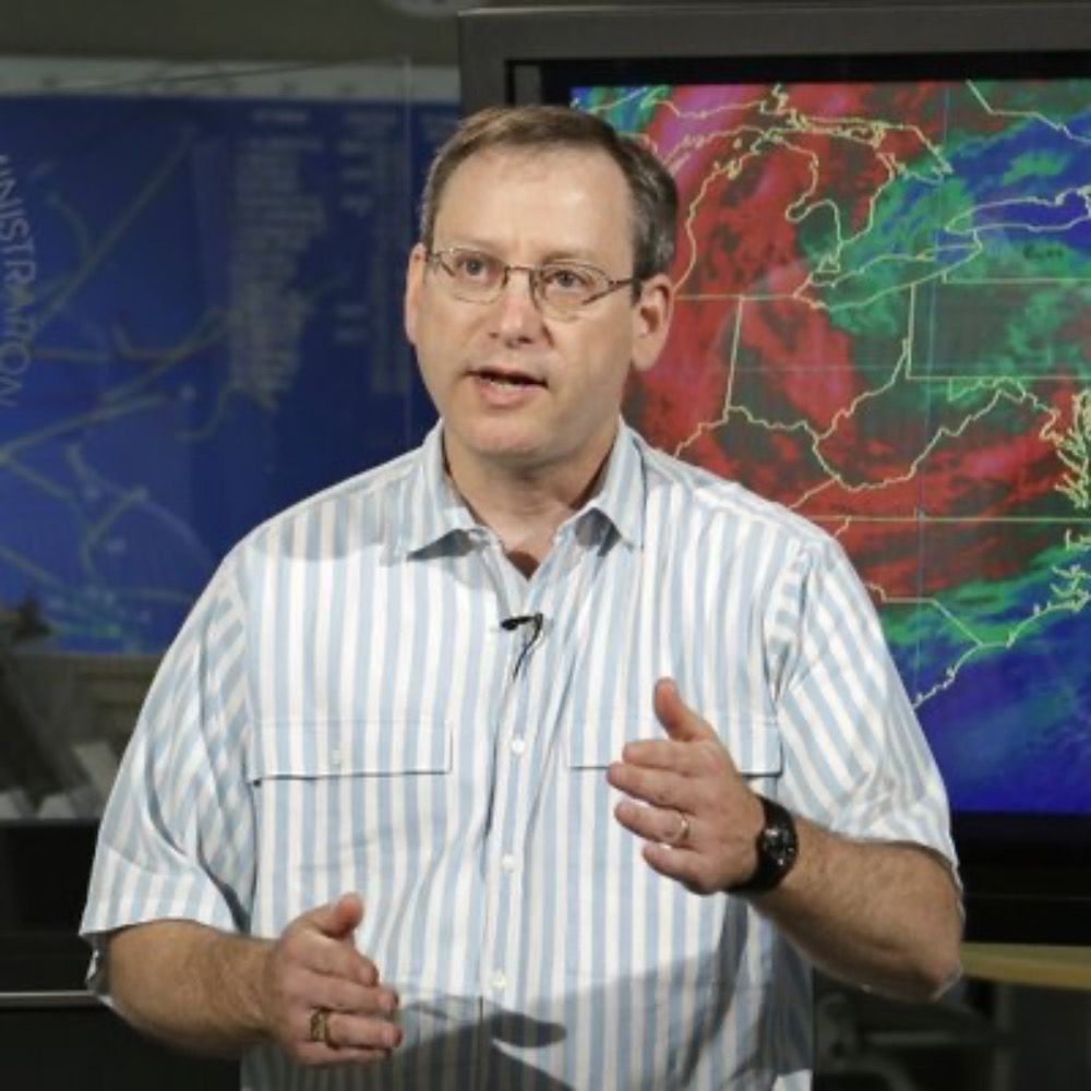
Today’s bloodbath at NWS reminds me of discussions over the years about the limits of predictability in weather forecasting. I would have never guessed that we’re gonna hit that limit in the US because of two insane rich guys.
February 27, 2025 at 10:32 PM
Today’s bloodbath at NWS reminds me of discussions over the years about the limits of predictability in weather forecasting. I would have never guessed that we’re gonna hit that limit in the US because of two insane rich guys.
Reposted by Kalain Hosein 🇹🇹

All probationary federal employees at NOAA’s EMC that’s responsible for keeping all US weather model systems running have been fired with 1 hours notice. And that includes me and colleagues. We will not go quietly because we care about the NOAA mission to protect the public.
February 27, 2025 at 9:18 PM
All probationary federal employees at NOAA’s EMC that’s responsible for keeping all US weather model systems running have been fired with 1 hours notice. And that includes me and colleagues. We will not go quietly because we care about the NOAA mission to protect the public.
Reposted by Kalain Hosein 🇹🇹

New: Layoffs underway of probationary employees at @noaa.gov Unclear so far how many were exempted for public safety reasons at the Nat'l Weather Service, NOAA Satellites and other units. www.axios.com/2025/02/27/l...
Layoffs hit federal climate, weather agency NOAA
The cuts could affect NOAA's weather forecasts, climate research and other functions.
www.axios.com
February 27, 2025 at 8:46 PM
New: Layoffs underway of probationary employees at @noaa.gov Unclear so far how many were exempted for public safety reasons at the Nat'l Weather Service, NOAA Satellites and other units. www.axios.com/2025/02/27/l...
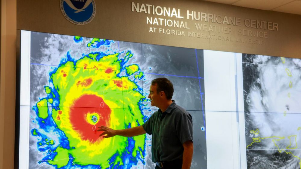
What a tragic day for the meteorology and geosciences community, not just within the U.S., but globally.
Caribbean meteorologists and disaster managers rely on data, forecasts and other products from the NWS/NOAA daily.
www.axios.com/2025/02/27/l...
Caribbean meteorologists and disaster managers rely on data, forecasts and other products from the NWS/NOAA daily.
www.axios.com/2025/02/27/l...

February 27, 2025 at 9:52 PM
What a tragic day for the meteorology and geosciences community, not just within the U.S., but globally.
Caribbean meteorologists and disaster managers rely on data, forecasts and other products from the NWS/NOAA daily.
www.axios.com/2025/02/27/l...
Caribbean meteorologists and disaster managers rely on data, forecasts and other products from the NWS/NOAA daily.
www.axios.com/2025/02/27/l...
Peak wind gusts are expected tonight into tomorrow.
Already, we’ve seen:
Piarco: 55 KM/H
Cumuto: 72.4 KM/H
Coalmine: 52.2 KM/H
Lambeau (Tobago): 50.4 KM/H
Secure any loose outdoor objects!
Already, we’ve seen:
Piarco: 55 KM/H
Cumuto: 72.4 KM/H
Coalmine: 52.2 KM/H
Lambeau (Tobago): 50.4 KM/H
Secure any loose outdoor objects!
Trinidad and Tobago is under a High Wind Alert until 6:00 PM Thursday, as wind gusts this week have a high potential to exceed 55 KM/H.
Secure all loose outdoor objects and livestock, and marine interests should exercise heightened caution.
ttweathercenter.com/2025/01/20/h...
Secure all loose outdoor objects and livestock, and marine interests should exercise heightened caution.
ttweathercenter.com/2025/01/20/h...

High Wind Alert In Effect For T&T - Gusts May Exceed 55 KM/H
Gusty winds in excess of 55 KM/H are forecast for Trinidad and Tobago, especially near showers from Monday through Thursday.
ttweathercenter.com
January 20, 2025 at 7:48 PM
Peak wind gusts are expected tonight into tomorrow.
Already, we’ve seen:
Piarco: 55 KM/H
Cumuto: 72.4 KM/H
Coalmine: 52.2 KM/H
Lambeau (Tobago): 50.4 KM/H
Secure any loose outdoor objects!
Already, we’ve seen:
Piarco: 55 KM/H
Cumuto: 72.4 KM/H
Coalmine: 52.2 KM/H
Lambeau (Tobago): 50.4 KM/H
Secure any loose outdoor objects!
Reposted by Kalain Hosein 🇹🇹
Wave heights offshore have now reached 3.0 meters (and above!).
A Hazardous Seas Alert remains in effect for Trinidad and Tobago until 6:00 PM Thursday.
All marine interests are advised to exercise extreme caution.
ttweathercenter.com/2025/01/20/h...
A Hazardous Seas Alert remains in effect for Trinidad and Tobago until 6:00 PM Thursday.
All marine interests are advised to exercise extreme caution.
ttweathercenter.com/2025/01/20/h...
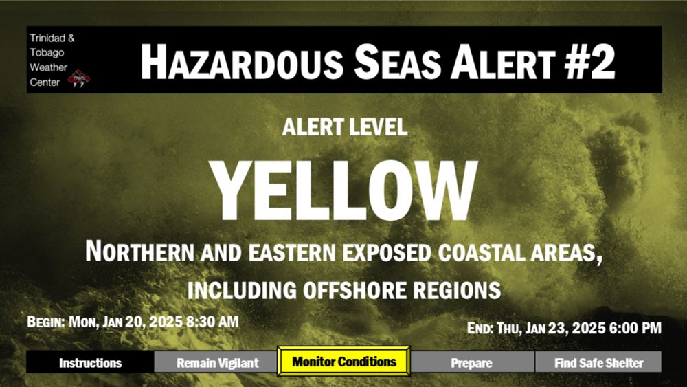
Hazardous Seas Alert In Effect As Open Water Waves Reach 3.0m
A Hazardous Seas Alert has been issued for T&T from Monday through January 23rd. Marine interests need to exercise caution!
ttweathercenter.com
January 20, 2025 at 7:28 PM
Wave heights offshore have now reached 3.0 meters (and above!).
A Hazardous Seas Alert remains in effect for Trinidad and Tobago until 6:00 PM Thursday.
All marine interests are advised to exercise extreme caution.
ttweathercenter.com/2025/01/20/h...
A Hazardous Seas Alert remains in effect for Trinidad and Tobago until 6:00 PM Thursday.
All marine interests are advised to exercise extreme caution.
ttweathercenter.com/2025/01/20/h...
Reposted by Kalain Hosein 🇹🇹

On Jan 22 4-4:30pm ET, join us for Climate COP Roundtable: Experiences & Insights on Global Action with our grad students @haleycrim.bsky.social, Amy Campbell, @kalain.bsky.social. HS students/educators, undergrads, grad students, the public, RSVP (FREE!): www.climate.columbia.edu/events/clima...

January 17, 2025 at 2:55 PM
On Jan 22 4-4:30pm ET, join us for Climate COP Roundtable: Experiences & Insights on Global Action with our grad students @haleycrim.bsky.social, Amy Campbell, @kalain.bsky.social. HS students/educators, undergrads, grad students, the public, RSVP (FREE!): www.climate.columbia.edu/events/clima...

Reposted by Kalain Hosein 🇹🇹
2024 was hottest year in NASA's record, stretching back to 1880, and past 10 years were warmest 10 years on record. Scientists have concluded that human activities, particularly release of heat-trapping greenhouse gases, are causing this long-term trend: news.climate.columbia.edu/2025/01/10/2...

January 12, 2025 at 4:28 PM
2024 was hottest year in NASA's record, stretching back to 1880, and past 10 years were warmest 10 years on record. Scientists have concluded that human activities, particularly release of heat-trapping greenhouse gases, are causing this long-term trend: news.climate.columbia.edu/2025/01/10/2...
Reposted by Kalain Hosein 🇹🇹
On Jan 22 4-4:30pm ET, join us for Climate COP Roundtable: Experiences & Insights on Global Action with our grad students @haleycrim.bsky.social, Amy Campbell, @kalain.bsky.social. HS students/educators, undergrads, grad students, the public, RSVP (FREE!): www.climate.columbia.edu/events/clima...
January 6, 2025 at 8:23 PM
On Jan 22 4-4:30pm ET, join us for Climate COP Roundtable: Experiences & Insights on Global Action with our grad students @haleycrim.bsky.social, Amy Campbell, @kalain.bsky.social. HS students/educators, undergrads, grad students, the public, RSVP (FREE!): www.climate.columbia.edu/events/clima...
The last time one of these were issued, it also combined with Spring Tides (which are currently ongoing), we saw:
- Maracas Bay (the parking facility and North Coast Road) flood
- Pigeon Point Jetty damaged
- Coastal flooding in Mayaro
- Maracas Bay (the parking facility and North Coast Road) flood
- Pigeon Point Jetty damaged
- Coastal flooding in Mayaro
A significant long-period swell event is forecast to begin tonight with T&T's second-ever Orange-Level Hazardous Seas Alert issued for T&T.
The TTMS is advising the public to "Restrict nearshore marine activities."
ttweathercenter.com/2024/11/28/h...
The TTMS is advising the public to "Restrict nearshore marine activities."
ttweathercenter.com/2024/11/28/h...

Hazardous Seas Alert Issued For T&T: Severe Impacts Likely
A significant long-period swell event is forecast to begin tonight with the second-ever Orange-Level Hazardous Seas Alert in effect for T&T.
ttweathercenter.com
November 28, 2024 at 5:05 PM
The last time one of these were issued, it also combined with Spring Tides (which are currently ongoing), we saw:
- Maracas Bay (the parking facility and North Coast Road) flood
- Pigeon Point Jetty damaged
- Coastal flooding in Mayaro
- Maracas Bay (the parking facility and North Coast Road) flood
- Pigeon Point Jetty damaged
- Coastal flooding in Mayaro
Reposted by Kalain Hosein 🇹🇹
An Adverse Weather Alert is now in effect for both T&T through 4:00 PM Wednesday as heavy rains, flooding, and landslides are possible.
While most of the country is forecast to experience rainfall, heavier activity is forecast to favor northern areas of T&T.
ttweathercenter.com/2024/11/26/a...
While most of the country is forecast to experience rainfall, heavier activity is forecast to favor northern areas of T&T.
ttweathercenter.com/2024/11/26/a...

Adverse Weather Alert Expanded For T&T: Heavy Rainfall Forecast
An Adverse Weather Alert is now in effect for both T&T through 4:00 PM Wednesday as heavy rains bring the threat of floods and landslides.
ttweathercenter.com
November 26, 2024 at 7:14 PM
An Adverse Weather Alert is now in effect for both T&T through 4:00 PM Wednesday as heavy rains, flooding, and landslides are possible.
While most of the country is forecast to experience rainfall, heavier activity is forecast to favor northern areas of T&T.
ttweathercenter.com/2024/11/26/a...
While most of the country is forecast to experience rainfall, heavier activity is forecast to favor northern areas of T&T.
ttweathercenter.com/2024/11/26/a...
And we’re back
Looks like it’s time to start using this a bit more.
November 14, 2024 at 4:21 PM
And we’re back
Looks like it’s time to start using this a bit more.
July 1, 2023 at 10:41 PM
Looks like it’s time to start using this a bit more.
Reposted by Kalain Hosein 🇹🇹

I think the funniest thing bluesky can do right now is send everyone another invite

July 1, 2023 at 5:23 PM
I think the funniest thing bluesky can do right now is send everyone another invite
The 2023 Wet Season has officially begun in Trinidad and Tobago with measurable rainfall recorded following the passage of Tropical Wave 04.
This is the 10 consecutive Wet Season declaration in May.
Additional showers/thunderstorms are forecast into the weekend across T&T.
This is the 10 consecutive Wet Season declaration in May.
Additional showers/thunderstorms are forecast into the weekend across T&T.

May 26, 2023 at 10:57 PM
The 2023 Wet Season has officially begun in Trinidad and Tobago with measurable rainfall recorded following the passage of Tropical Wave 04.
This is the 10 consecutive Wet Season declaration in May.
Additional showers/thunderstorms are forecast into the weekend across T&T.
This is the 10 consecutive Wet Season declaration in May.
Additional showers/thunderstorms are forecast into the weekend across T&T.