


Geoinformation in Environmental Planning @ TU Berlin
@geo-tub.bsky.social
Our three-day KI-Recover workshop at the Bavarian Forest National Park wrapped up with a snowy, insightful visit to the project sites. We’re already very much looking forward to the next meeting. #KIRecover #ForestRecovery#ReforestationMonitoring #KI


November 22, 2025 at 1:35 PM
Our three-day KI-Recover workshop at the Bavarian Forest National Park wrapped up with a snowy, insightful visit to the project sites. We’re already very much looking forward to the next meeting. #KIRecover #ForestRecovery#ReforestationMonitoring #KI
Last week we joined the municipal workshop on Earth observation as part of the EO4Nature project led by LUP. From 2027, EO4Nature—funded by the ANK—will offer municipalities free, up-to-date satellite-based environmental insights. Great discussions on local needs! #NatürlicherKlimaschutz #ANK

November 21, 2025 at 7:31 PM
Last week we joined the municipal workshop on Earth observation as part of the EO4Nature project led by LUP. From 2027, EO4Nature—funded by the ANK—will offer municipalities free, up-to-date satellite-based environmental insights. Great discussions on local needs! #NatürlicherKlimaschutz #ANK
Reposted by Geoinformation in Environmental Planning @ TU Berlin
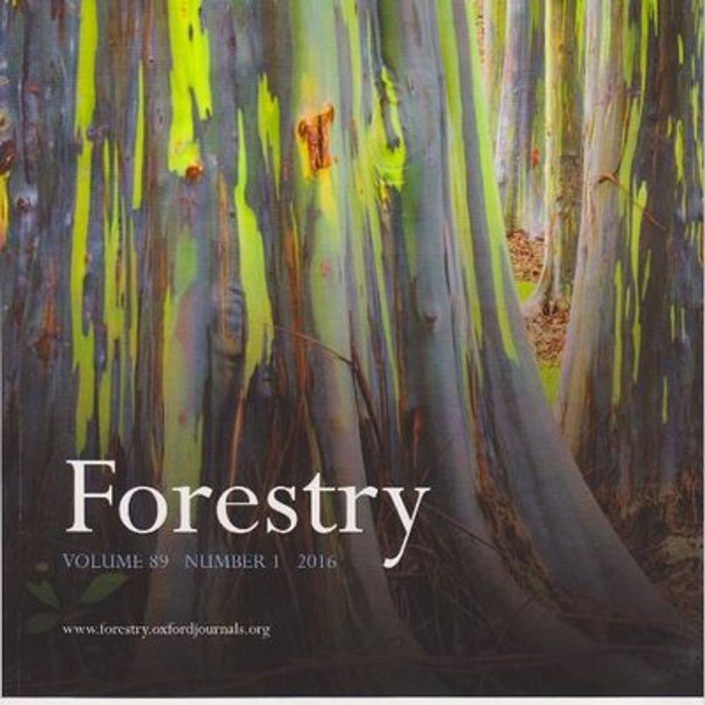
Out now:
A synthesis on open canopy conditions from forest management on biodiversity by Larsen-Gray and colleagues. 🌲🪵
🔗 doi.org/10.1093/fore...
A synthesis on open canopy conditions from forest management on biodiversity by Larsen-Gray and colleagues. 🌲🪵
🔗 doi.org/10.1093/fore...

November 21, 2025 at 12:52 PM
Out now:
A synthesis on open canopy conditions from forest management on biodiversity by Larsen-Gray and colleagues. 🌲🪵
🔗 doi.org/10.1093/fore...
A synthesis on open canopy conditions from forest management on biodiversity by Larsen-Gray and colleagues. 🌲🪵
🔗 doi.org/10.1093/fore...
funded by/gefördert durch @fnr.de


October 22, 2025 at 1:49 PM
funded by/gefördert durch @fnr.de
Semester kickoff! 🚀
GIS, remote sensing, statistics and a hands-on study project are underway — plus we’re welcoming @bendechant.bsky.social as our newest lecturer!
GIS, remote sensing, statistics and a hands-on study project are underway — plus we’re welcoming @bendechant.bsky.social as our newest lecturer!
October 15, 2025 at 12:02 PM
Semester kickoff! 🚀
GIS, remote sensing, statistics and a hands-on study project are underway — plus we’re welcoming @bendechant.bsky.social as our newest lecturer!
GIS, remote sensing, statistics and a hands-on study project are underway — plus we’re welcoming @bendechant.bsky.social as our newest lecturer!
Reposted by Geoinformation in Environmental Planning @ TU Berlin
A new semester kicks off this week at Berlin’s universities - back to campus vibes! 🎓✨ Our team is ready for a winter term of teaching GIS & remote sensing at Lankwitz. Wishing students & lecturers alike a semester full of learning, discovery & good energy! 🚀📚🌍 #FreieUniversität #BackToCampus
October 15, 2025 at 7:17 AM
A new semester kicks off this week at Berlin’s universities - back to campus vibes! 🎓✨ Our team is ready for a winter term of teaching GIS & remote sensing at Lankwitz. Wishing students & lecturers alike a semester full of learning, discovery & good energy! 🚀📚🌍 #FreieUniversität #BackToCampus
Reposted by Geoinformation in Environmental Planning @ TU Berlin
Our new online application EVA-MAP provides interactive maps of vegetation plots from the European Vegetation Archive and ReSurveyEurope databases. It enables filtering the plots by various criteria. More details can be found in this new article in the IAVS Bulletin:
www.sci.muni.cz/botany/chytr...
www.sci.muni.cz/botany/chytr...

October 11, 2025 at 5:54 AM
Our new online application EVA-MAP provides interactive maps of vegetation plots from the European Vegetation Archive and ReSurveyEurope databases. It enables filtering the plots by various criteria. More details can be found in this new article in the IAVS Bulletin:
www.sci.muni.cz/botany/chytr...
www.sci.muni.cz/botany/chytr...
Reposted by Geoinformation in Environmental Planning @ TU Berlin
🚀 Call for abstracts now open! We’re excited to announce that the 14th EARSeL Workshop on Imaging Spectroscopy will take place at Aalto University, Finland, in 2026 — and the call for abstracts is now open! 🌍👉 Learn more and submit your abstract: is.earsel.org/workshop/14-IS-Helsinki2026/

October 7, 2025 at 11:02 AM
🚀 Call for abstracts now open! We’re excited to announce that the 14th EARSeL Workshop on Imaging Spectroscopy will take place at Aalto University, Finland, in 2026 — and the call for abstracts is now open! 🌍👉 Learn more and submit your abstract: is.earsel.org/workshop/14-IS-Helsinki2026/
We welcomed our new Environmental Planning Master’s students this week! 🌿
Orientation wrapped up with insights from Dr. Basem Aljoumani on the SAVE Water research project 💧
#EnvironmentalPlanning #Sustainability #WaterResearch
Orientation wrapped up with insights from Dr. Basem Aljoumani on the SAVE Water research project 💧
#EnvironmentalPlanning #Sustainability #WaterResearch

October 8, 2025 at 1:15 PM
We welcomed our new Environmental Planning Master’s students this week! 🌿
Orientation wrapped up with insights from Dr. Basem Aljoumani on the SAVE Water research project 💧
#EnvironmentalPlanning #Sustainability #WaterResearch
Orientation wrapped up with insights from Dr. Basem Aljoumani on the SAVE Water research project 💧
#EnvironmentalPlanning #Sustainability #WaterResearch
Reposted by Geoinformation in Environmental Planning @ TU Berlin
The nomination deadline for 2026 @ecologicalsociety.bsky.social awards is coming up on November 13, 2025! This year we're accepting nominations for the inaugural Bazzaz-Pickett Award for inclusive mentorship in ecology. We'd love to see as many nominations as possible! esa.org/about/awards/
esa.org
October 6, 2025 at 5:47 AM
The nomination deadline for 2026 @ecologicalsociety.bsky.social awards is coming up on November 13, 2025! This year we're accepting nominations for the inaugural Bazzaz-Pickett Award for inclusive mentorship in ecology. We'd love to see as many nominations as possible! esa.org/about/awards/
📢Paper alert #2:
Modeling grassland parameters with hyperspectral satellite data.... doi.org/10.1016/j.ja...
Key takeaway: The selection of timing and spectral data is crucial for accurate biomass and species composition models.
#EnMAP #DESIS #PRISMA
Modeling grassland parameters with hyperspectral satellite data.... doi.org/10.1016/j.ja...
Key takeaway: The selection of timing and spectral data is crucial for accurate biomass and species composition models.
#EnMAP #DESIS #PRISMA
Redirecting
doi.org
October 5, 2025 at 1:46 PM
📢Paper alert #2:
Modeling grassland parameters with hyperspectral satellite data.... doi.org/10.1016/j.ja...
Key takeaway: The selection of timing and spectral data is crucial for accurate biomass and species composition models.
#EnMAP #DESIS #PRISMA
Modeling grassland parameters with hyperspectral satellite data.... doi.org/10.1016/j.ja...
Key takeaway: The selection of timing and spectral data is crucial for accurate biomass and species composition models.
#EnMAP #DESIS #PRISMA
📢Paper alert:
Methodological considerations for studying spectral-plant diversity relationships doi.org/10.1016/j.rs...
Key takeaway: Be cautious—illumination corrections may unintentionally alter diversity patterns, potentially biasing ecological interpretations.
#UAV #hyperspectral #diversity
Methodological considerations for studying spectral-plant diversity relationships doi.org/10.1016/j.rs...
Key takeaway: Be cautious—illumination corrections may unintentionally alter diversity patterns, potentially biasing ecological interpretations.
#UAV #hyperspectral #diversity
Redirecting
doi.org
October 5, 2025 at 1:39 PM
📢Paper alert:
Methodological considerations for studying spectral-plant diversity relationships doi.org/10.1016/j.rs...
Key takeaway: Be cautious—illumination corrections may unintentionally alter diversity patterns, potentially biasing ecological interpretations.
#UAV #hyperspectral #diversity
Methodological considerations for studying spectral-plant diversity relationships doi.org/10.1016/j.rs...
Key takeaway: Be cautious—illumination corrections may unintentionally alter diversity patterns, potentially biasing ecological interpretations.
#UAV #hyperspectral #diversity
Reposted by Geoinformation in Environmental Planning @ TU Berlin

Great news! 🌱 Last week Christine Wallis and Robert Jackisch received funding for KI-Recover, supported by the German Environment Ministry. The project uses AI to boost sustainable forestry — from climate-resilient tree selection to smarter reforestation. 🌳🤖
#AI #ClimateAction #Forests
#AI #ClimateAction #Forests

October 5, 2025 at 1:07 PM
Great news! 🌱 Last week Christine Wallis and Robert Jackisch received funding for KI-Recover, supported by the German Environment Ministry. The project uses AI to boost sustainable forestry — from climate-resilient tree selection to smarter reforestation. 🌳🤖
#AI #ClimateAction #Forests
#AI #ClimateAction #Forests
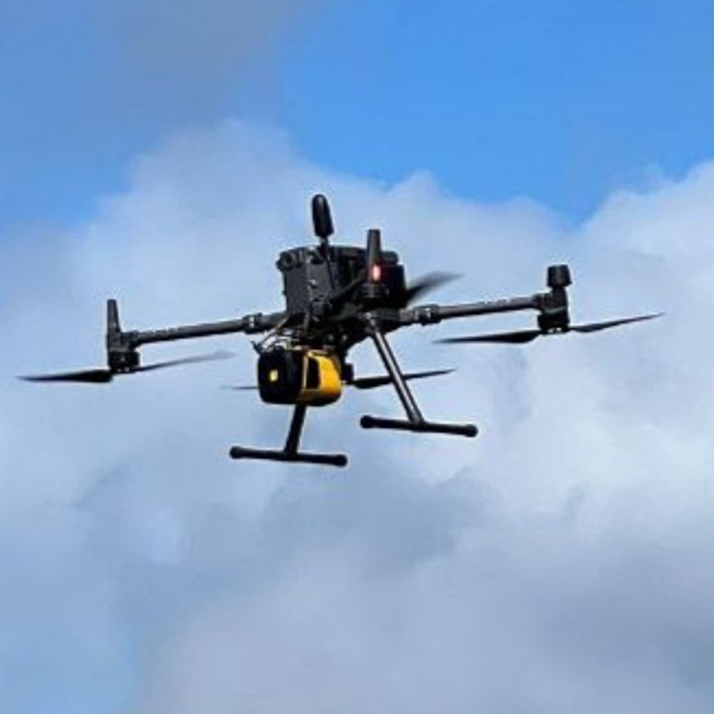
Last week, we took advantage of the last few nice days to conduct the final drone flight for our KI Recover project – Now we have to evaluate more than five weeks of fieldwork. #KI-Recover

September 25, 2025 at 12:37 PM
Last week, we took advantage of the last few nice days to conduct the final drone flight for our KI Recover project – Now we have to evaluate more than five weeks of fieldwork. #KI-Recover
Reposted by Geoinformation in Environmental Planning @ TU Berlin
We were delighted to host a research exchange with colleagues from @CzechGlobe 🇨🇿 in Berlin! 🌍
We discussed forestry-focused remote sensing, explored opportunities for future collaboration, and visited study sites like the #sensorfield in Brandenburg. 🌲📡
Thanks for the great visit!
#TeamScience
We discussed forestry-focused remote sensing, explored opportunities for future collaboration, and visited study sites like the #sensorfield in Brandenburg. 🌲📡
Thanks for the great visit!
#TeamScience


September 14, 2025 at 7:23 AM
We were delighted to host a research exchange with colleagues from @CzechGlobe 🇨🇿 in Berlin! 🌍
We discussed forestry-focused remote sensing, explored opportunities for future collaboration, and visited study sites like the #sensorfield in Brandenburg. 🌲📡
Thanks for the great visit!
#TeamScience
We discussed forestry-focused remote sensing, explored opportunities for future collaboration, and visited study sites like the #sensorfield in Brandenburg. 🌲📡
Thanks for the great visit!
#TeamScience
Reposted by Geoinformation in Environmental Planning @ TU Berlin
Looking for a #postdoct for a NSF project integrating ecosystem productivity, hyperspectral remote sensing and airborne LiDAR to test prominent hypothesis of the effect of #biodiversity on #forest #productivity @fluxnetecn.bsky.social @ngaps.bsky.social Apply at: jobs.colostate.edu/postings/165...

September 6, 2025 at 1:14 AM
Looking for a #postdoct for a NSF project integrating ecosystem productivity, hyperspectral remote sensing and airborne LiDAR to test prominent hypothesis of the effect of #biodiversity on #forest #productivity @fluxnetecn.bsky.social @ngaps.bsky.social Apply at: jobs.colostate.edu/postings/165...
Reposted by Geoinformation in Environmental Planning @ TU Berlin
🌱 New project: KI-Recover — a collaborative project using AI + remote sensing (drones, satellites, aerial data) and ecological expertise to improve reforestation management.
From monitoring forests to predicting risks, we use data to understand long-term forest recovery dynamics. (1/3)
From monitoring forests to predicting risks, we use data to understand long-term forest recovery dynamics. (1/3)

August 14, 2025 at 4:26 PM
🌱 New project: KI-Recover — a collaborative project using AI + remote sensing (drones, satellites, aerial data) and ecological expertise to improve reforestation management.
From monitoring forests to predicting risks, we use data to understand long-term forest recovery dynamics. (1/3)
From monitoring forests to predicting risks, we use data to understand long-term forest recovery dynamics. (1/3)
Our sensor data will be compared with sap flow, dendrometer, and stomatal conductance measurements in Adlershof street trees. Together, these indicators show plant water status and stress — a key step toward improving urban vegetation resilience under climate change.
#SAVE_Water #Berlin
#SAVE_Water #Berlin

August 13, 2025 at 1:20 PM
Our sensor data will be compared with sap flow, dendrometer, and stomatal conductance measurements in Adlershof street trees. Together, these indicators show plant water status and stress — a key step toward improving urban vegetation resilience under climate change.
#SAVE_Water #Berlin
#SAVE_Water #Berlin
We're using
Meter Group 5TE – measures volumetric water content, temperature, and EC.
HydraGO by Stevens Water – portable sensor for instant soil measurements.
#SAVE_Water #PlantWaterStress
Meter Group 5TE – measures volumetric water content, temperature, and EC.
HydraGO by Stevens Water – portable sensor for instant soil measurements.
#SAVE_Water #PlantWaterStress

August 13, 2025 at 1:11 PM
We're using
Meter Group 5TE – measures volumetric water content, temperature, and EC.
HydraGO by Stevens Water – portable sensor for instant soil measurements.
#SAVE_Water #PlantWaterStress
Meter Group 5TE – measures volumetric water content, temperature, and EC.
HydraGO by Stevens Water – portable sensor for instant soil measurements.
#SAVE_Water #PlantWaterStress
Detecting Plant Water Stress – SAVE Water Project
As part of the PRIMA-funded SAVE Water project, we are preparing to monitor soil moisture, soil temperature, and soil electrical conductivity (EC) to help detect water stress in urban trees.
#SAVE_Water #PlantWaterStress
As part of the PRIMA-funded SAVE Water project, we are preparing to monitor soil moisture, soil temperature, and soil electrical conductivity (EC) to help detect water stress in urban trees.
#SAVE_Water #PlantWaterStress

August 13, 2025 at 1:08 PM
Detecting Plant Water Stress – SAVE Water Project
As part of the PRIMA-funded SAVE Water project, we are preparing to monitor soil moisture, soil temperature, and soil electrical conductivity (EC) to help detect water stress in urban trees.
#SAVE_Water #PlantWaterStress
As part of the PRIMA-funded SAVE Water project, we are preparing to monitor soil moisture, soil temperature, and soil electrical conductivity (EC) to help detect water stress in urban trees.
#SAVE_Water #PlantWaterStress
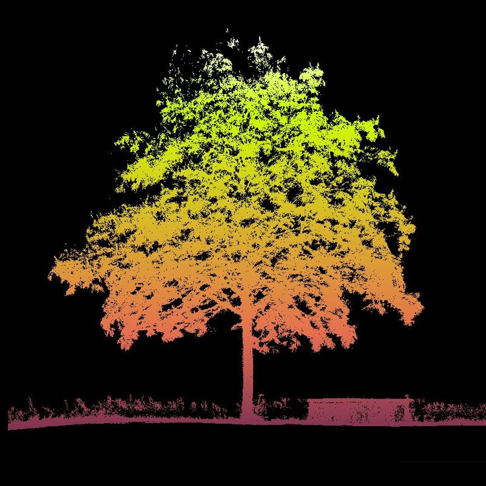
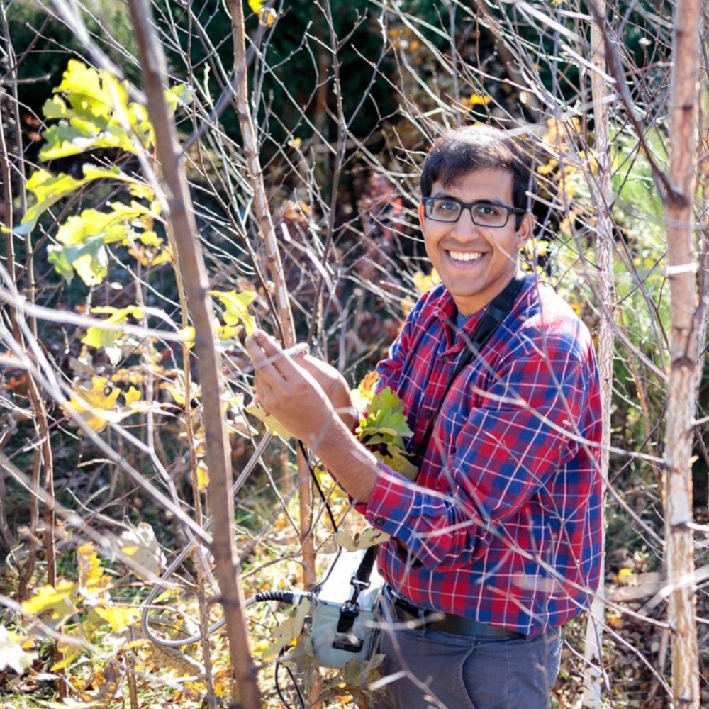
We are using drones and sensors to investigate areas affected by forest dieback. We are mapping deadwood and collecting data on regeneration, mortality, species composition and age structures.

August 8, 2025 at 3:17 PM
We are using drones and sensors to investigate areas affected by forest dieback. We are mapping deadwood and collecting data on regeneration, mortality, species composition and age structures.
We are Caileigh, Robert and Kiran (from right to left) and we are currently in the Harz Mountains conducting field research. As part of the AI Recover project, we are investigating areas affected by forest dieback.

August 8, 2025 at 3:14 PM
We are Caileigh, Robert and Kiran (from right to left) and we are currently in the Harz Mountains conducting field research. As part of the AI Recover project, we are investigating areas affected by forest dieback.