Eddie Garcia
banner
eddiegarcia-kob.bsky.social
Eddie Garcia
@eddiegarcia-kob.bsky.social
Chief Meteorologist at KOB 4 TV (NBC) in Albuquerque, New Mexico
www.kob.com
Here's a look at some severe hail in Edgewood this evening! I-40 will continue to be hit with storms like this. Video by Mark Robbins. #nmwx #SevereWeather #hailstorm
June 9, 2025 at 11:46 PM
Reposted by Eddie Garcia
Eastern NM #tornado a few minutes ago. Post from X. #WxSky
June 5, 2025 at 9:47 PM
A severe storm is DUMPING HAIL on Isleta Pueblo! Now there's a new FLASH FLOOD WARNING in the area. Avoid I-25 south of the metro at all cost, while the storm is hitting! #nmwx
June 4, 2025 at 9:43 PM
🚨Four Corners area —keep an eye on the weather in northwest New Mexico today. Storms could bring rain rates up to 1.5” an hour, with local totals near 3”. That’s enough to cause flash flooding in canyons, arroyos, and burn scars.

A Flood Watch is in effect through 7pm. Stay weather-aware and safe!
June 4, 2025 at 6:20 PM
Some #ABQ streets are flowing like arroyos! Thanks to Robert Bundy for the video. #nmwx #abq #flashflood
June 2, 2025 at 9:20 PM
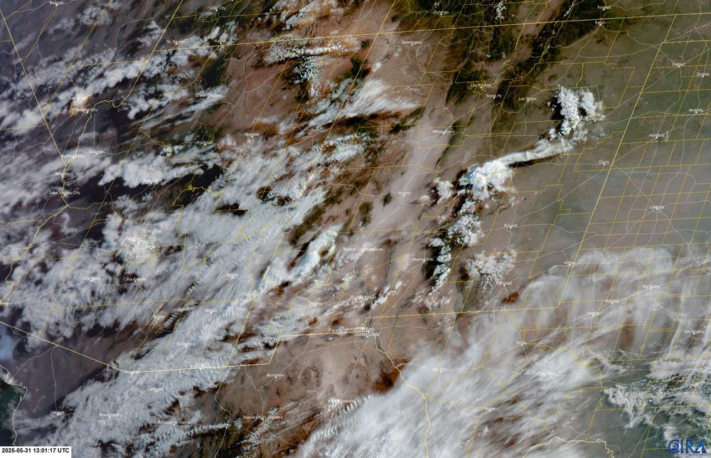
If it looked a little hazy this morning, here’s why: storms last night helped push smoke up from northern Mexico. That settled into the Rio Grande Valley and dropped visibility.

It’s mostly cleared out now, but that’s what had things looking a bit milky earlier today. #nmwx
May 31, 2025 at 6:57 PM
A landspout just SE of Carlsbad - just about 20 mins ago! No reports of injuries. A landspout is like a dust devil boosted by a thunderstorm — visually dramatic, but usually weak. Video courtesy of Zachery Mobley #nmwx #carlsbadnm
May 29, 2025 at 9:36 PM
Follow-up on the widely shared Floyd, NM tornado (May 25):
Damage survey is in — rated EF-1 with peak winds near 90 mph. It snapped 30+ power poles, clipped a dairy, and mangled a farm sprinkler. Thankfully, it missed homes. No injuries. Photo: Bill Kardokus🌪️ #nmwx #FloydTornado #TornadoUpdate
May 28, 2025 at 8:18 PM
Whew! A lot of action in some NM areas today. For instance, here's what our Roswell Skycam recorded during a severe warned storm this evening. Excuse the shakiness of the video but if you look at the top, you can see the storm rotating. A funnel appears briefly but never touches down. #nmwx
May 27, 2025 at 3:43 AM
🚨 Flash Flood Risk Tonight

Heavy rain is building across central and eastern New Mexico, with some spots seeing up to 3 inches. Storms may repeat over the same areas, raising the risk for flash flooding, especially in low spots and burn scars.

Stay alert overnight!

#nmwx #floodrisk
May 6, 2025 at 5:19 AM
Reposted by Eddie Garcia
ABQ issues Severe Thunderstorm Warning [wind: 60 MPH (RADAR INDICATED), hail: 1.00 IN (RADAR INDICATED)] for Bernalillo, Sandoval [NM] till 3:00 PM MDT Link
May 4, 2025 at 8:09 PM
North Valley snow in late April! ❄️🐣 #ABQ #nmwx
April 19, 2025 at 6:41 PM
Sizzlin' Saturday!
April 10, 2025 at 11:52 PM
DUST STORM ALERT! It's going to be a rough rush hour in the #ABQ metro and surrounding areas. Beware of blinding dust and low-to-no visibility along roads. The high wind will ease after sunset. #NMWX
March 18, 2025 at 8:42 PM
A 3,000 acre wildfire is un-contained and growing on private land in Mora Co. It’s east of I-25 and south of Wagon Mound. There are scattered houses in the area - here’s the latest from law enforcement. #NMfire #NMwx
March 14, 2025 at 9:25 PM
Here's what 70 mph winds will do to a roof in Clovis, NM! Be careful out there, you never know what is airborne! Thanks to Wendell Malone for sharing this vid. #wind #clovis #nmwx
March 14, 2025 at 8:55 PM
Snow showers are now moving through west I-40 near Gallup and Zuni Pueblo. Visibility is dropping to 1/4 mile and may deteriorate later this evening. Use extreme caution if heading that way. #nmwx #snow
March 7, 2025 at 10:58 PM
DUST STORM WARNING for ABQ Metro until 5:00 pm (Thursday) Visibility may drop to zero at times, with wind gusts as high as 65mph! Avoid driving if possible!
March 6, 2025 at 9:54 PM
Tomorrow is going to be an INTENSE weather day! High wind and extreme fire risk will be accompanied by blinding dust storms and potential power outages. Take extreme caution if you need to venture out - or postpone if possible. #nmwx
March 6, 2025 at 5:27 AM
Brace for tomorrow!
Wind: Round 2
March 6, 2025 at 12:43 AM
Here's the Snow Moon rise tonight at Navajo Lake! Some North American tribes named it the Hungry Moon due to the scarce food sources and hard hunting conditions during mid-winter, while others named it Bear Moon, referring to bear cubs being born this time of year. #nmwx #snowmoon
February 13, 2025 at 5:16 AM
Have a great weekend ya'll! #nmwx
February 8, 2025 at 4:51 AM
Beware of smoke blowing across I-25 near Isleta Blvd! Firefighters are battling a barn fire just off the interstate - no injuries reported. Dry and windy conditions are bringing more fire risk to NM this week - so be careful out there! #nmwx #nmfire
February 4, 2025 at 11:51 PM
Record breaking warmth in #ABQ #nmwx
February 3, 2025 at 11:21 PM
Warm weekend ahead 😎
January 31, 2025 at 5:31 AM