


We’re heading to Auckland 🇳🇿 for @foss4g2025.bsky.social to talk Rust 🦀 + open geospatial.
Catch our team showing how modern tools make geospatial faster and more interoperable.
Find us for zines + join the GeoRust sprint.
Get the deets: developmentseed.org/blog/2025-10...
#foss4g #osgeo
Catch our team showing how modern tools make geospatial faster and more interoperable.
Find us for zines + join the GeoRust sprint.
Get the deets: developmentseed.org/blog/2025-10...
#foss4g #osgeo

November 7, 2025 at 3:14 PM
We’re heading to Auckland 🇳🇿 for @foss4g2025.bsky.social to talk Rust 🦀 + open geospatial.
Catch our team showing how modern tools make geospatial faster and more interoperable.
Find us for zines + join the GeoRust sprint.
Get the deets: developmentseed.org/blog/2025-10...
#foss4g #osgeo
Catch our team showing how modern tools make geospatial faster and more interoperable.
Find us for zines + join the GeoRust sprint.
Get the deets: developmentseed.org/blog/2025-10...
#foss4g #osgeo
We took Canada’s Spatial Access Measures dataset (big, clunky CSVs) → turned it into a single GeoParquet file.
Add DuckDB-WASM + deck.gl & you get
- instant queries
- smooth maps
- no backend
Public data, but actually usable.
developmentseed.org/blog/2025-10...
@saadiqmohiuddin.bsky.social
Add DuckDB-WASM + deck.gl & you get
- instant queries
- smooth maps
- no backend
Public data, but actually usable.
developmentseed.org/blog/2025-10...
@saadiqmohiuddin.bsky.social
November 6, 2025 at 6:38 PM
We took Canada’s Spatial Access Measures dataset (big, clunky CSVs) → turned it into a single GeoParquet file.
Add DuckDB-WASM + deck.gl & you get
- instant queries
- smooth maps
- no backend
Public data, but actually usable.
developmentseed.org/blog/2025-10...
@saadiqmohiuddin.bsky.social
Add DuckDB-WASM + deck.gl & you get
- instant queries
- smooth maps
- no backend
Public data, but actually usable.
developmentseed.org/blog/2025-10...
@saadiqmohiuddin.bsky.social

We’re hiring a Cloud Engineer (EU/UK) 🌍
Help build open-source, cloud-native geospatial + AI tools with partners like ESA, NASA & ECMWF.
Remote-first from an ESA member state or join us in Lisbon.
grnh.se/9f2aodg43us
#hiring #jobs #geospatial #europe
Help build open-source, cloud-native geospatial + AI tools with partners like ESA, NASA & ECMWF.
Remote-first from an ESA member state or join us in Lisbon.
grnh.se/9f2aodg43us
#hiring #jobs #geospatial #europe

October 29, 2025 at 6:10 PM
We’re hiring a Cloud Engineer (EU/UK) 🌍
Help build open-source, cloud-native geospatial + AI tools with partners like ESA, NASA & ECMWF.
Remote-first from an ESA member state or join us in Lisbon.
grnh.se/9f2aodg43us
#hiring #jobs #geospatial #europe
Help build open-source, cloud-native geospatial + AI tools with partners like ESA, NASA & ECMWF.
Remote-first from an ESA member state or join us in Lisbon.
grnh.se/9f2aodg43us
#hiring #jobs #geospatial #europe
See you at @foss4gna.bsky.social in Reston next week!
We’re sharing:
• eoAPI for humanitarian maps
• stac-geoparquet + stac-map
• VirtualiZarr
• an eoAPI workshop (still time to sign up!)
👋 Grab a zine and say hi
developmentseed.org/blog/2025-10...
We’re sharing:
• eoAPI for humanitarian maps
• stac-geoparquet + stac-map
• VirtualiZarr
• an eoAPI workshop (still time to sign up!)
👋 Grab a zine and say hi
developmentseed.org/blog/2025-10...

October 29, 2025 at 5:06 PM
See you at @foss4gna.bsky.social in Reston next week!
We’re sharing:
• eoAPI for humanitarian maps
• stac-geoparquet + stac-map
• VirtualiZarr
• an eoAPI workshop (still time to sign up!)
👋 Grab a zine and say hi
developmentseed.org/blog/2025-10...
We’re sharing:
• eoAPI for humanitarian maps
• stac-geoparquet + stac-map
• VirtualiZarr
• an eoAPI workshop (still time to sign up!)
👋 Grab a zine and say hi
developmentseed.org/blog/2025-10...
DevSeed intern Beatriz Peres used ESA’s new Sentinel-1 Zarr to analyze the 2024 Valencia floods with lightweight, time-series workflows.
Her blog shows how Zarr + xarray make flood monitoring faster & more flexible: developmentseed.org/blog/2025-09...
#BiDS25 @thrivegeo.bsky.social
Her blog shows how Zarr + xarray make flood monitoring faster & more flexible: developmentseed.org/blog/2025-09...
#BiDS25 @thrivegeo.bsky.social

October 1, 2025 at 7:11 PM
DevSeed intern Beatriz Peres used ESA’s new Sentinel-1 Zarr to analyze the 2024 Valencia floods with lightweight, time-series workflows.
Her blog shows how Zarr + xarray make flood monitoring faster & more flexible: developmentseed.org/blog/2025-09...
#BiDS25 @thrivegeo.bsky.social
Her blog shows how Zarr + xarray make flood monitoring faster & more flexible: developmentseed.org/blog/2025-09...
#BiDS25 @thrivegeo.bsky.social
At #BiDS2025 this week!
At two demos we're sharing how to make Sentinel data more accessible and actionable:
🔹 Sentinel Zarr Explorer
🔹 EOPF Toolkit + Notebook Competition with @thrivegeo.bsky.social
Agenda: bids25-signup.esa.int/agenda
We'd love to chat!
#EarthObservation #BigData #CloudNative
At two demos we're sharing how to make Sentinel data more accessible and actionable:
🔹 Sentinel Zarr Explorer
🔹 EOPF Toolkit + Notebook Competition with @thrivegeo.bsky.social
Agenda: bids25-signup.esa.int/agenda
We'd love to chat!
#EarthObservation #BigData #CloudNative

September 29, 2025 at 6:17 PM
At #BiDS2025 this week!
At two demos we're sharing how to make Sentinel data more accessible and actionable:
🔹 Sentinel Zarr Explorer
🔹 EOPF Toolkit + Notebook Competition with @thrivegeo.bsky.social
Agenda: bids25-signup.esa.int/agenda
We'd love to chat!
#EarthObservation #BigData #CloudNative
At two demos we're sharing how to make Sentinel data more accessible and actionable:
🔹 Sentinel Zarr Explorer
🔹 EOPF Toolkit + Notebook Competition with @thrivegeo.bsky.social
Agenda: bids25-signup.esa.int/agenda
We'd love to chat!
#EarthObservation #BigData #CloudNative
A big group of us is headed to SatCamp this week to hike, bike & scheme with an amazing community of EO enthusiasts & experts. Will we see you there?
September 22, 2025 at 11:23 PM
A big group of us is headed to SatCamp this week to hike, bike & scheme with an amazing community of EO enthusiasts & experts. Will we see you there?
@worldresources.bsky.social call to move past the hype and use AI responsibly for public good resonates with how we've approached AI in our work. This is the conversation to pay attention to — don’t miss the livestream this week.
Sign up: landcarbonlab.org/events/ai-me...
Sign up: landcarbonlab.org/events/ai-me...

September 15, 2025 at 8:57 PM
@worldresources.bsky.social call to move past the hype and use AI responsibly for public good resonates with how we've approached AI in our work. This is the conversation to pay attention to — don’t miss the livestream this week.
Sign up: landcarbonlab.org/events/ai-me...
Sign up: landcarbonlab.org/events/ai-me...
We're running another edition of our Foundation Models workshop. This time at EarthSense 2025.
attend.ieee.org/earthsense-2...
#ai #geoai #foundationmodels #remotesensing #earthsense2025
@sunu.bsky.social
attend.ieee.org/earthsense-2...
#ai #geoai #foundationmodels #remotesensing #earthsense2025
@sunu.bsky.social

September 15, 2025 at 3:41 PM
We're running another edition of our Foundation Models workshop. This time at EarthSense 2025.
attend.ieee.org/earthsense-2...
#ai #geoai #foundationmodels #remotesensing #earthsense2025
@sunu.bsky.social
attend.ieee.org/earthsense-2...
#ai #geoai #foundationmodels #remotesensing #earthsense2025
@sunu.bsky.social
We built stac-map, a lightweight, map-first prototype for exploring STAC GeoParquet in your browser. Built w/ DuckDB, geoarrow, & semantic STAC search, explore STAC GeoParquet files directly in the browser.
Try it: developmentseed.org/stac-map/
Blog: ds.io/stac-map
@gadom.ski @indraneel.org
Try it: developmentseed.org/stac-map/
Blog: ds.io/stac-map
@gadom.ski @indraneel.org
September 9, 2025 at 6:55 PM
We built stac-map, a lightweight, map-first prototype for exploring STAC GeoParquet in your browser. Built w/ DuckDB, geoarrow, & semantic STAC search, explore STAC GeoParquet files directly in the browser.
Try it: developmentseed.org/stac-map/
Blog: ds.io/stac-map
@gadom.ski @indraneel.org
Try it: developmentseed.org/stac-map/
Blog: ds.io/stac-map
@gadom.ski @indraneel.org
Moving terabytes of cloud data in Python was too slow & messy—so we built Obstore.
⚡ Fast & stateless
☁️ Works with S3, GCS, & Azure
🐍 Rust-backed, no dependencies
It’s already powering cloud-native geospatial tools.
Read the blog: ds.io/obstore-blog
⚡ Fast & stateless
☁️ Works with S3, GCS, & Azure
🐍 Rust-backed, no dependencies
It’s already powering cloud-native geospatial tools.
Read the blog: ds.io/obstore-blog

August 5, 2025 at 4:24 PM
Moving terabytes of cloud data in Python was too slow & messy—so we built Obstore.
⚡ Fast & stateless
☁️ Works with S3, GCS, & Azure
🐍 Rust-backed, no dependencies
It’s already powering cloud-native geospatial tools.
Read the blog: ds.io/obstore-blog
⚡ Fast & stateless
☁️ Works with S3, GCS, & Azure
🐍 Rust-backed, no dependencies
It’s already powering cloud-native geospatial tools.
Read the blog: ds.io/obstore-blog
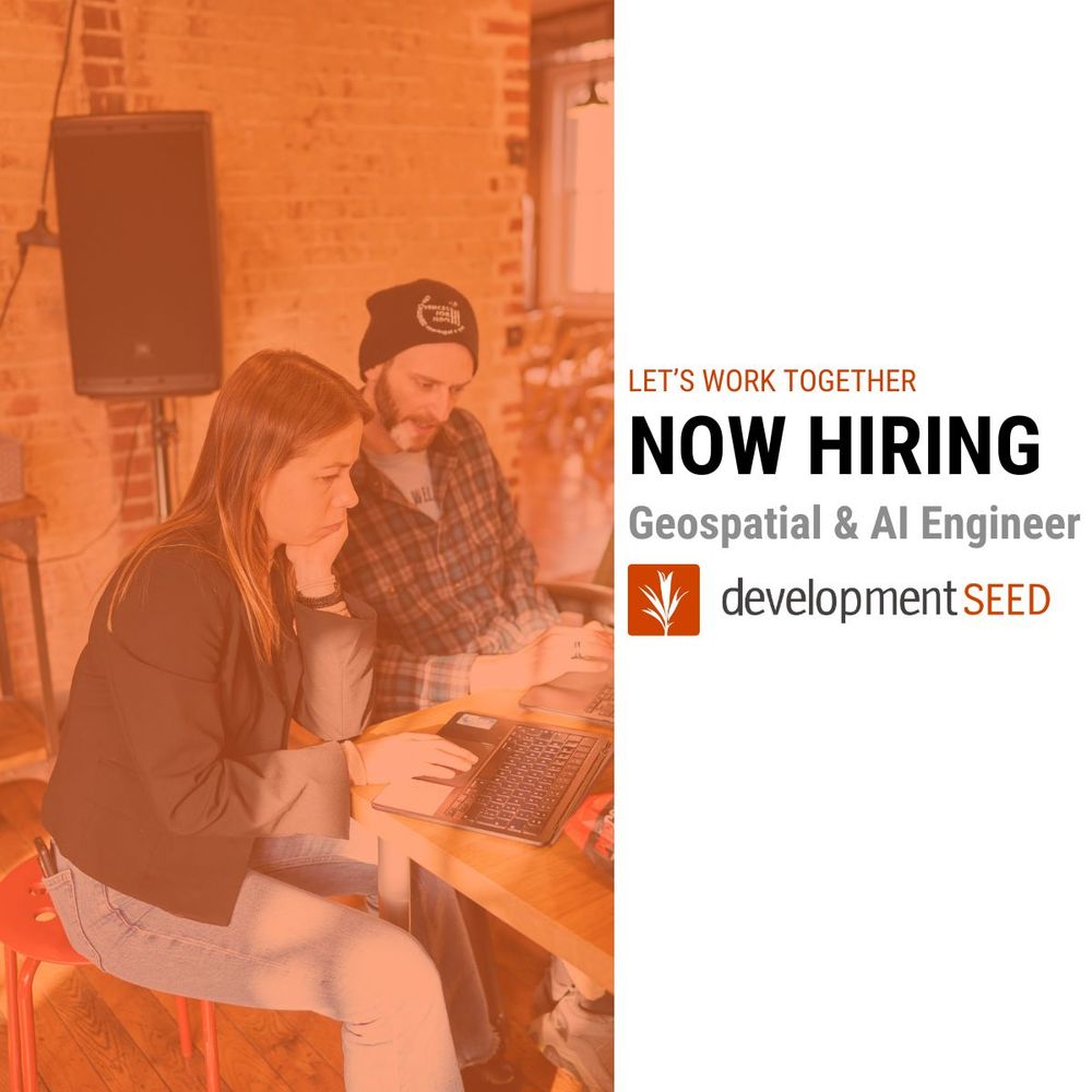
📢 We’re hiring and looking for a Geospatial & AI Engineer. This is a remote-first position; however, you must reside in an ESA member country to be eligible to apply.
This role focuses on backend engineering & cloud-native pipelines. AI/LLM skills are a plus, but not a must.
grnh.se/al8eavv03us
This role focuses on backend engineering & cloud-native pipelines. AI/LLM skills are a plus, but not a must.
grnh.se/al8eavv03us
July 23, 2025 at 9:34 PM
📢 We’re hiring and looking for a Geospatial & AI Engineer. This is a remote-first position; however, you must reside in an ESA member country to be eligible to apply.
This role focuses on backend engineering & cloud-native pipelines. AI/LLM skills are a plus, but not a must.
grnh.se/al8eavv03us
This role focuses on backend engineering & cloud-native pipelines. AI/LLM skills are a plus, but not a must.
grnh.se/al8eavv03us
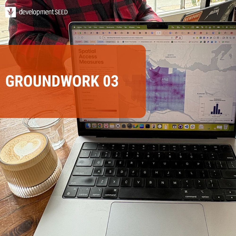
The latest Groundwork is live on the blog!
We’re experimenting with:
• Rust CQL2 playground
• DuckDB+GeoParquet spatial analysis in-browser
• Semantic STAC search
• Zarr visualizations
• DB-free STAC search
Read more + join in the fun:
ds.io/groundwork-03
We’re experimenting with:
• Rust CQL2 playground
• DuckDB+GeoParquet spatial analysis in-browser
• Semantic STAC search
• Zarr visualizations
• DB-free STAC search
Read more + join in the fun:
ds.io/groundwork-03
July 22, 2025 at 6:08 PM
The latest Groundwork is live on the blog!
We’re experimenting with:
• Rust CQL2 playground
• DuckDB+GeoParquet spatial analysis in-browser
• Semantic STAC search
• Zarr visualizations
• DB-free STAC search
Read more + join in the fun:
ds.io/groundwork-03
We’re experimenting with:
• Rust CQL2 playground
• DuckDB+GeoParquet spatial analysis in-browser
• Semantic STAC search
• Zarr visualizations
• DB-free STAC search
Read more + join in the fun:
ds.io/groundwork-03
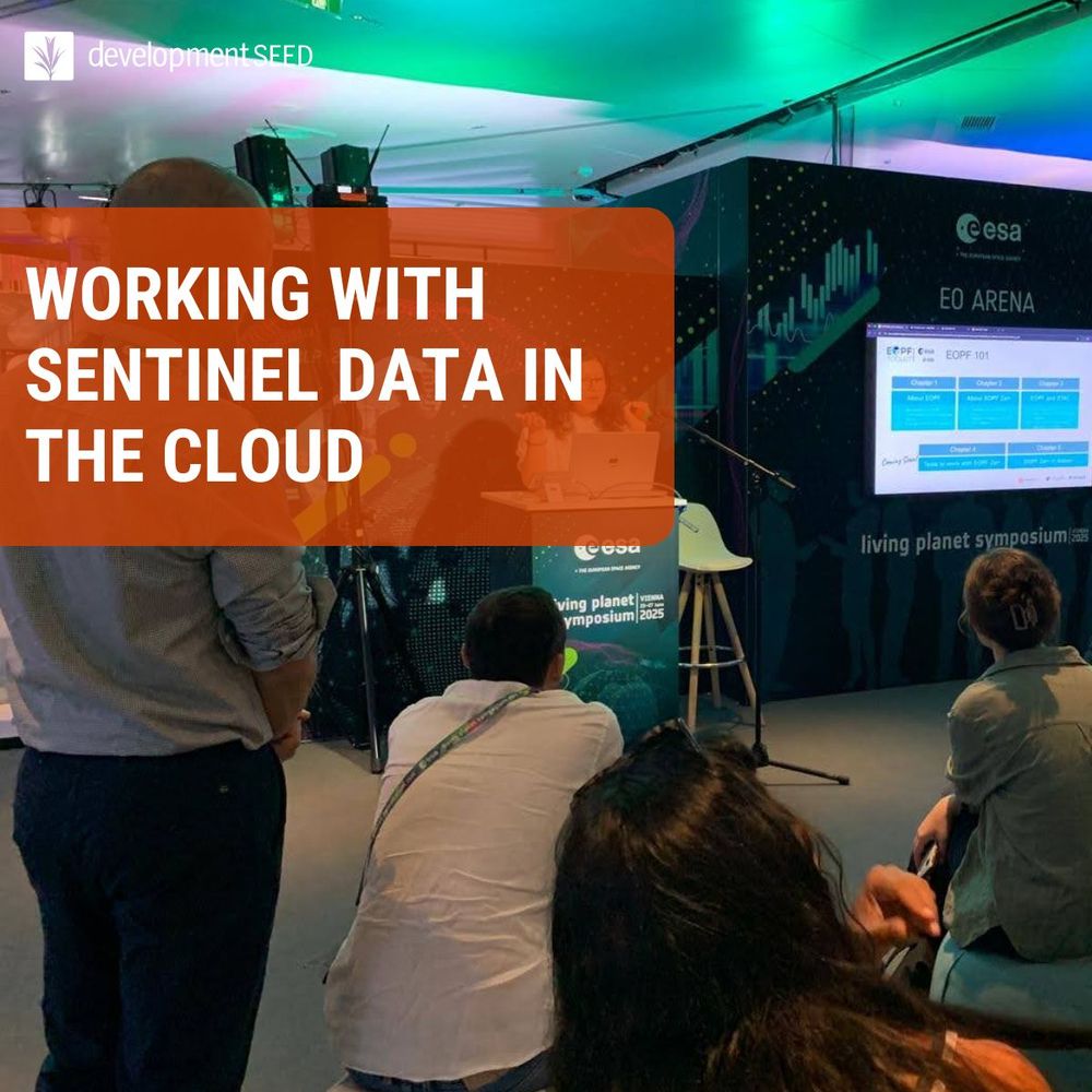
🌍 New blog: Working with Sentinel Data in the Cloud
ds.io/eopf101
EOPF 101 is your hands-on guide to using Sentinel data in cloud-native formats like Zarr and STAC. Includes working notebooks, applied workflows, and an open processing environment.
ds.io/eopf101
EOPF 101 is your hands-on guide to using Sentinel data in cloud-native formats like Zarr and STAC. Includes working notebooks, applied workflows, and an open processing environment.
July 16, 2025 at 6:59 PM
🌍 New blog: Working with Sentinel Data in the Cloud
ds.io/eopf101
EOPF 101 is your hands-on guide to using Sentinel data in cloud-native formats like Zarr and STAC. Includes working notebooks, applied workflows, and an open processing environment.
ds.io/eopf101
EOPF 101 is your hands-on guide to using Sentinel data in cloud-native formats like Zarr and STAC. Includes working notebooks, applied workflows, and an open processing environment.
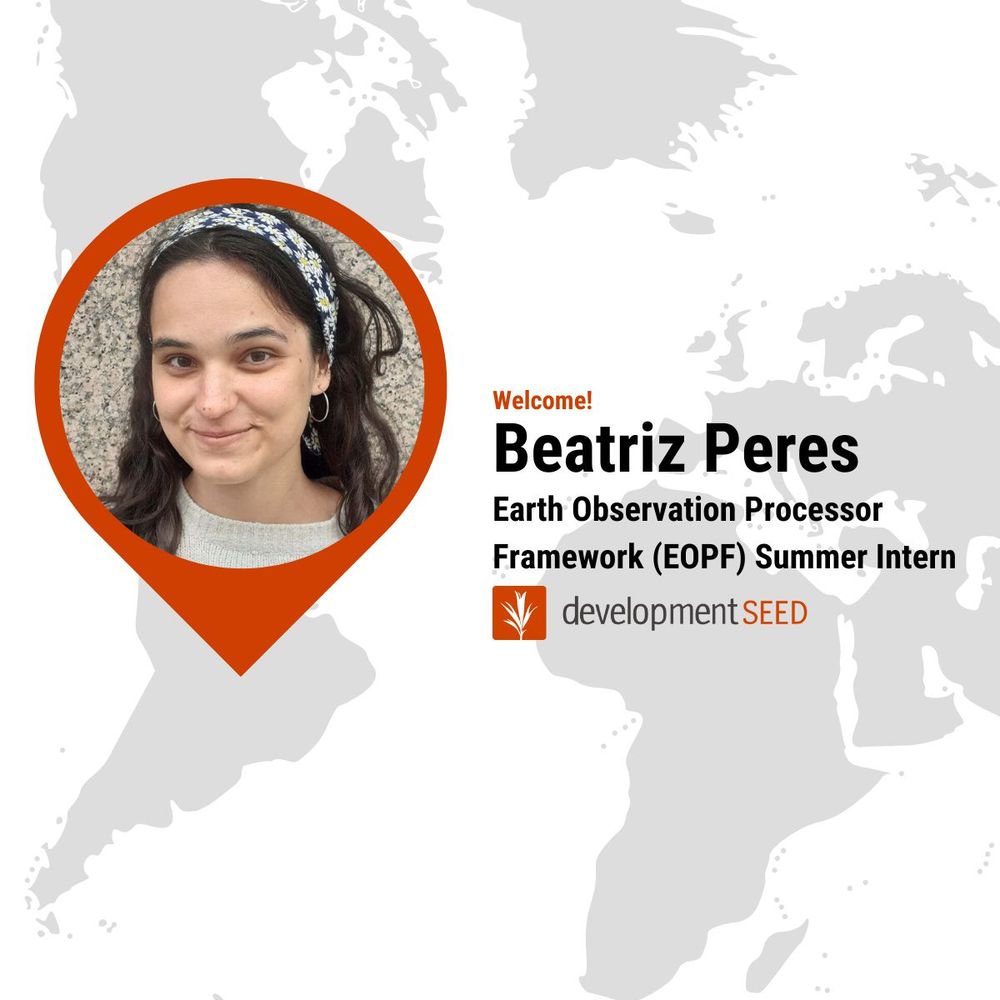
We are excited to welcome Beatriz Peres to the team! Over the summer, she'll work on the ESA EOPF Toolkit project (eopf-toolkit.github.io/eopf-101/) with our Lisbon-based team.
Beatriz is a geospatial engineer & master's student who loves working with open-source tools, SAR imagery, & LiDAR.
Beatriz is a geospatial engineer & master's student who loves working with open-source tools, SAR imagery, & LiDAR.
July 11, 2025 at 5:43 PM
We are excited to welcome Beatriz Peres to the team! Over the summer, she'll work on the ESA EOPF Toolkit project (eopf-toolkit.github.io/eopf-101/) with our Lisbon-based team.
Beatriz is a geospatial engineer & master's student who loves working with open-source tools, SAR imagery, & LiDAR.
Beatriz is a geospatial engineer & master's student who loves working with open-source tools, SAR imagery, & LiDAR.
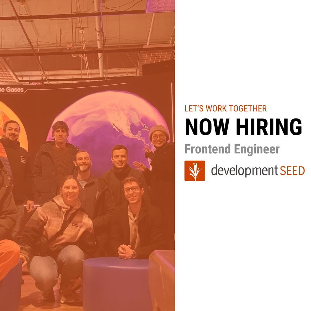
We’re hiring a senior-level Frontend Engineer!
This role is about building tools that help people use Earth data to tackle real-world problems — from climate and conservation to disaster response and open science.
Remote, open-source, and meaningful.
Details + apply: grnh.se/39qfi0m13us
This role is about building tools that help people use Earth data to tackle real-world problems — from climate and conservation to disaster response and open science.
Remote, open-source, and meaningful.
Details + apply: grnh.se/39qfi0m13us
July 7, 2025 at 9:59 PM
We’re hiring a senior-level Frontend Engineer!
This role is about building tools that help people use Earth data to tackle real-world problems — from climate and conservation to disaster response and open science.
Remote, open-source, and meaningful.
Details + apply: grnh.se/39qfi0m13us
This role is about building tools that help people use Earth data to tackle real-world problems — from climate and conservation to disaster response and open science.
Remote, open-source, and meaningful.
Details + apply: grnh.se/39qfi0m13us
June 17, 2025 at 7:59 PM
TiTiler-CMR
Dynamic tiling for Earth data
→ Pulls data straight from NASA’s CMR
→ Works with NetCDF, HDF5, COGs
→ Powers VEDA’s IMERG + HLS products
→ Fully open source
Blog: www.earthdata.nasa.gov/news/blog/vi...
Repo: developmentseed.org/titiler-cmr/...
Demo: www.loom.com/share/af6fef...
Dynamic tiling for Earth data
→ Pulls data straight from NASA’s CMR
→ Works with NetCDF, HDF5, COGs
→ Powers VEDA’s IMERG + HLS products
→ Fully open source
Blog: www.earthdata.nasa.gov/news/blog/vi...
Repo: developmentseed.org/titiler-cmr/...
Demo: www.loom.com/share/af6fef...
June 13, 2025 at 10:39 PM
TiTiler-CMR
Dynamic tiling for Earth data
→ Pulls data straight from NASA’s CMR
→ Works with NetCDF, HDF5, COGs
→ Powers VEDA’s IMERG + HLS products
→ Fully open source
Blog: www.earthdata.nasa.gov/news/blog/vi...
Repo: developmentseed.org/titiler-cmr/...
Demo: www.loom.com/share/af6fef...
Dynamic tiling for Earth data
→ Pulls data straight from NASA’s CMR
→ Works with NetCDF, HDF5, COGs
→ Powers VEDA’s IMERG + HLS products
→ Fully open source
Blog: www.earthdata.nasa.gov/news/blog/vi...
Repo: developmentseed.org/titiler-cmr/...
Demo: www.loom.com/share/af6fef...
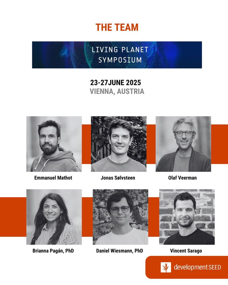
Will we see you at #LPS25?
Catch up with the team at one of our many sessions, demos, or contribute to our hands-on Sentinel-2 mosaic LEGO project.
Get all the details in our blog: ds.io/lps25
Catch up with the team at one of our many sessions, demos, or contribute to our hands-on Sentinel-2 mosaic LEGO project.
Get all the details in our blog: ds.io/lps25
June 11, 2025 at 4:11 PM
Will we see you at #LPS25?
Catch up with the team at one of our many sessions, demos, or contribute to our hands-on Sentinel-2 mosaic LEGO project.
Get all the details in our blog: ds.io/lps25
Catch up with the team at one of our many sessions, demos, or contribute to our hands-on Sentinel-2 mosaic LEGO project.
Get all the details in our blog: ds.io/lps25
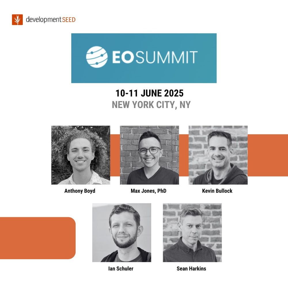
We are looking forward to seeing everyone at EO Summit next week!
We had such a great time last year that we're back again to help out by facilitating sessions on environmental intelligence, deforestation, and nature-based solutions.
If you'll be there also, we'd love to connect.
We had such a great time last year that we're back again to help out by facilitating sessions on environmental intelligence, deforestation, and nature-based solutions.
If you'll be there also, we'd love to connect.
June 6, 2025 at 8:46 PM
We are looking forward to seeing everyone at EO Summit next week!
We had such a great time last year that we're back again to help out by facilitating sessions on environmental intelligence, deforestation, and nature-based solutions.
If you'll be there also, we'd love to connect.
We had such a great time last year that we're back again to help out by facilitating sessions on environmental intelligence, deforestation, and nature-based solutions.
If you'll be there also, we'd love to connect.
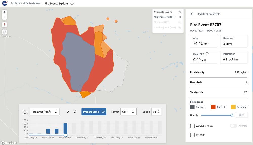
This is what enabling science looks like.
NASA IMPACT, the Wildfire Tracking Lab, and DevSeed are using VEDA to make earth data more transparent and usable.
Explore here → earthdata.nasa.gov/dashboard/to...
Blog → ds.io/fire-explorer
🧵4/4
NASA IMPACT, the Wildfire Tracking Lab, and DevSeed are using VEDA to make earth data more transparent and usable.
Explore here → earthdata.nasa.gov/dashboard/to...
Blog → ds.io/fire-explorer
🧵4/4
June 4, 2025 at 6:55 PM
This is what enabling science looks like.
NASA IMPACT, the Wildfire Tracking Lab, and DevSeed are using VEDA to make earth data more transparent and usable.
Explore here → earthdata.nasa.gov/dashboard/to...
Blog → ds.io/fire-explorer
🧵4/4
NASA IMPACT, the Wildfire Tracking Lab, and DevSeed are using VEDA to make earth data more transparent and usable.
Explore here → earthdata.nasa.gov/dashboard/to...
Blog → ds.io/fire-explorer
🧵4/4
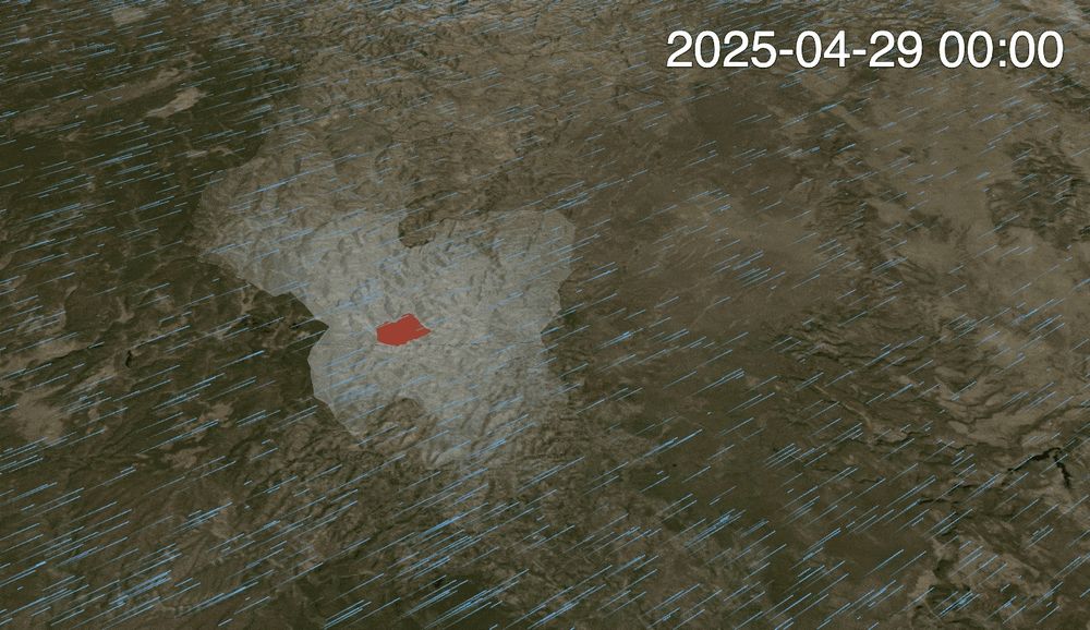
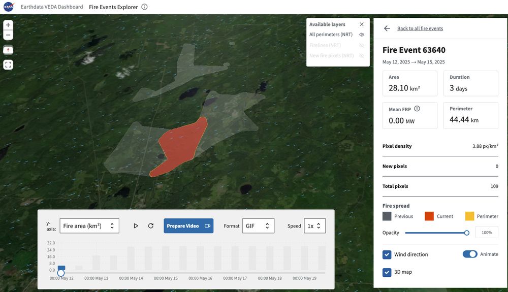
You can animate fire growth, visualize wind movement, even export your own GIFs or videos. Perfect for post-fire briefings, reports, or presentations.
NASA’s open data + cloud-native tools = public science in action. 🙌
🧵3/4
NASA’s open data + cloud-native tools = public science in action. 🙌
🧵3/4
June 4, 2025 at 6:34 PM
You can animate fire growth, visualize wind movement, even export your own GIFs or videos. Perfect for post-fire briefings, reports, or presentations.
NASA’s open data + cloud-native tools = public science in action. 🙌
🧵3/4
NASA’s open data + cloud-native tools = public science in action. 🙌
🧵3/4
This isn’t a disaster response tool.
It’s for fire analysts, journalists, local planners or anyone who needs to understand wildfire patterns, not just damage.
And it works right in the browser. No code. No GIS software.
🧵 2/4
It’s for fire analysts, journalists, local planners or anyone who needs to understand wildfire patterns, not just damage.
And it works right in the browser. No code. No GIS software.
🧵 2/4
June 4, 2025 at 6:34 PM
This isn’t a disaster response tool.
It’s for fire analysts, journalists, local planners or anyone who needs to understand wildfire patterns, not just damage.
And it works right in the browser. No code. No GIS software.
🧵 2/4
It’s for fire analysts, journalists, local planners or anyone who needs to understand wildfire patterns, not just damage.
And it works right in the browser. No code. No GIS software.
🧵 2/4