


claybears (Aaron Pulsifer)
@claybears.bsky.social
Annapolis Valley, NS, Canada 🇨🇦. Teenage weather enthusiast, running three weather stations. Public transit advocate and railfan.
*Take my forecasts with a grain of salt--not an actual meteorologist...yet
*Take my forecasts with a grain of salt--not an actual meteorologist...yet


November 29, 2025 at 11:14 AM
Pretty exceptional gust recorded in Plateau, Nova Scotia from Les Suêtes winds. Gust of 209 km/h was just recorded. That’s 130 mph. While unofficial, still historical. Data from CB Mesonet (capebretonweather.ca) @yhzweatherguy.bsky.social @allisteraalders.bsky.social @ryansnoddon.bsky.social

February 14, 2025 at 3:41 AM
Pretty exceptional gust recorded in Plateau, Nova Scotia from Les Suêtes winds. Gust of 209 km/h was just recorded. That’s 130 mph. While unofficial, still historical. Data from CB Mesonet (capebretonweather.ca) @yhzweatherguy.bsky.social @allisteraalders.bsky.social @ryansnoddon.bsky.social
Interestingly, temps are staying far below forecast. Still -8° in the valley with the forecast at -2,-3°. Just over 5 cm down in #Kentville. #NSstorm #Nswx #NSsnow

January 29, 2025 at 6:34 PM
Interestingly, temps are staying far below forecast. Still -8° in the valley with the forecast at -2,-3°. Just over 5 cm down in #Kentville. #NSstorm #Nswx #NSsnow
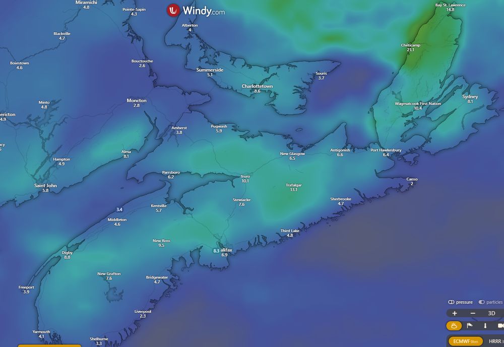
Cold front very visible on Mesonet data. Snow to begin soon for the Valley, and then Halifax. Stronger NW winds expected could cause blowing snow. And if in heavy snow: maybe white-out conditions

January 28, 2025 at 1:12 PM
Cold front very visible on Mesonet data. Snow to begin soon for the Valley, and then Halifax. Stronger NW winds expected could cause blowing snow. And if in heavy snow: maybe white-out conditions
Greenwood airport obs also reporting mix

January 20, 2025 at 3:59 AM
Greenwood airport obs also reporting mix
January 20, 2025 at 3:56 AM
After a rain event Sun., Mon is looking to be snowy. HFX area and east will likely see trace amounts of snowfall (mostly rain); however western NS and northern NS could see 5-15 cm by noon Mon. Heaviest snow in the morn may cause travel disruptions. Keep an eye on it. #NSstorm #NSwx #NSsnow


January 17, 2025 at 12:25 AM
Bay-effect snow continued through today. Not much accumulated in Kentville, at most 2 cm. Friday-Sunday storm total for me is 27 cm. Greenwood CFB confirming at 28 cm. Overall, close enough to forecast thanks to backend snow. Next snow event is Christmas eve: more to follow. #NSStorm #NSwx


December 22, 2024 at 9:08 PM

A snowfall warning has been released for mainland Nova Scotia. 15-30 cm is expected across the province (CB and Eastern Shore may see a change to rain) starting Fri eve/night dwindling Sat. For the Valley, Bay-enhanced/back-end snow could occur after the storm. (1/2) #Nsstorm #NSwx #NSsnow #wxbsky

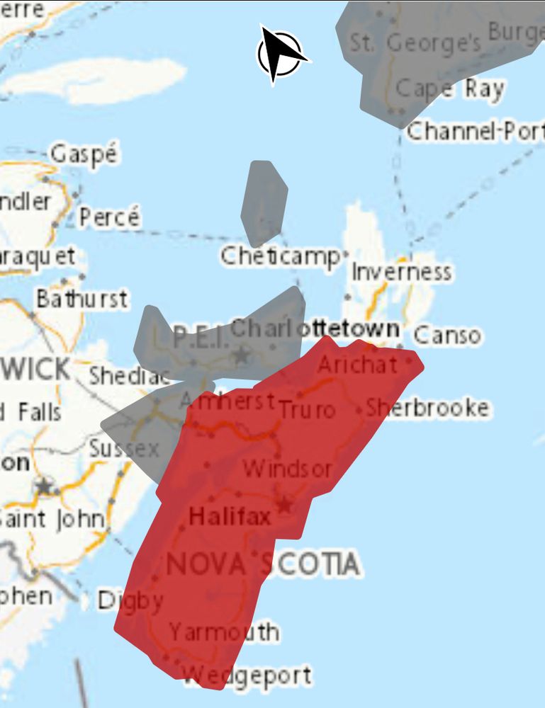
December 19, 2024 at 7:46 PM
Models now agree for a major snow event Sat. Track wobbles are still possible: affecting snow totals. Generally, 10-25 cm across NS (xcpt east CB) with higher totals under heavier bands. Up to even 40 cm in some models. Once forecast is final or just about I'll post my thoughts. #NSStorm #NSwx


December 18, 2024 at 8:34 PM
Consensus for a snowstorm effecting Atlantic Canada on Saturday is growing. While specifics can’t be ruled out, 10-30+ cm is possible across the whole region. Some models show it more offshore (GFS) but they seem to be trending back. Details TBD. Euro and Canadian models below ⬇️ #NSstorm #Nsstorm


December 17, 2024 at 12:18 PM

Freezing Rain Warning in effect for the Annapolis Valley and Northern NS along the Gulf. Freezing rain is ongoing here in Kentville and it's slippery out there. Freezing rain continues into the early evening where it will be replaced by normal rain when temps rise. Warmer tomorrow. #NSwx #NSstorm

December 10, 2024 at 5:54 PM


Watching Sunday the 8th for a small NS-wide snow event likely 👀. EURO & GFS models have a widespread 5 cm across the province with higher totals inland and higher elevation. Up to 20 possible for CB Highlands. Details TBD... #nswx #nsstorm #wxbsky #wxsky #snow #novascotia

December 6, 2024 at 2:05 AM


Measured 8 cm this morning in Kentville. This eve til tmr morn more snow squalls are expected, helped by the “warm” waters of the Bay. Around 5 cm tonight is possible. I’d say more is likely in areas where the bands set up good. First snowfall of the season: very wet and fluffy. #NSstorm #NSwx


December 1, 2024 at 4:42 PM


Windy and snowy here in Kentville! Starting to stick to the deck but will be long gone by morning time
November 29, 2024 at 2:53 AM
Windy and snowy here in Kentville! Starting to stick to the deck but will be long gone by morning time
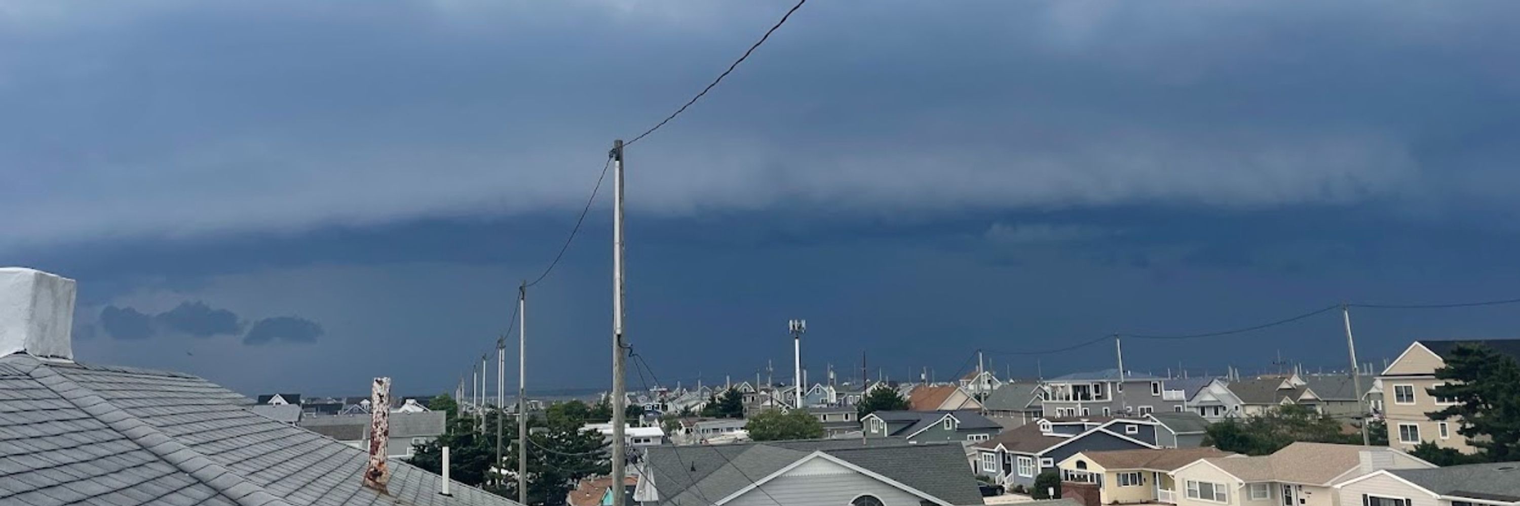
Looks pretty intense on the North Mountain!
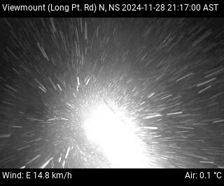
November 29, 2024 at 1:30 AM
Looks pretty intense on the North Mountain!
