Brooke Brighton
banner
brookebrighton.bsky.social
Brooke Brighton
@brookebrighton.bsky.social
TV Meteorologist at Spectrum News 1 WI & Spectrum News KC.
Nature photo enthusiast. 📸🌅
Graduate of THE Ohio State University.
Goals: Bright(o)n your day. ☀️😀
Pinned
Looks like nothing but blue skies on the @bsky.app ! 😎☀️💙🦋
#Snow pushes in to #Wisconsin late Friday night, impacting all of the state Saturday. Most impactful time period will be Saturday afternoon - evening. For more details, check out our weather breakout article: spectrumnews1.com/wi/milwaukee...
November 28, 2025 at 3:23 PM
Make sure to bundle up if you're participating in #BlackFriday shopping as temperatures will be in the 20s with wind chills in the teens. 🛍️
November 28, 2025 at 2:40 PM
Reposted by Brooke Brighton
@brookebrighton.bsky.social

WETW3-West Allis-8A

Temp: 21
DP: 15
Wind Chill: 14
Wind: W at 7
Sky: CLR

Previous 24 hours ending at 8A

MAX Temp: 31
MIN Temp: 20
Ave Temp: 26 -7.9

Precipitation: Trace
Snow: Trace
Snow on Ground: Trace
Frost Depth Sod: 0”
Frost Dpth Bare Gnd: 0”
November 28, 2025 at 1:50 PM
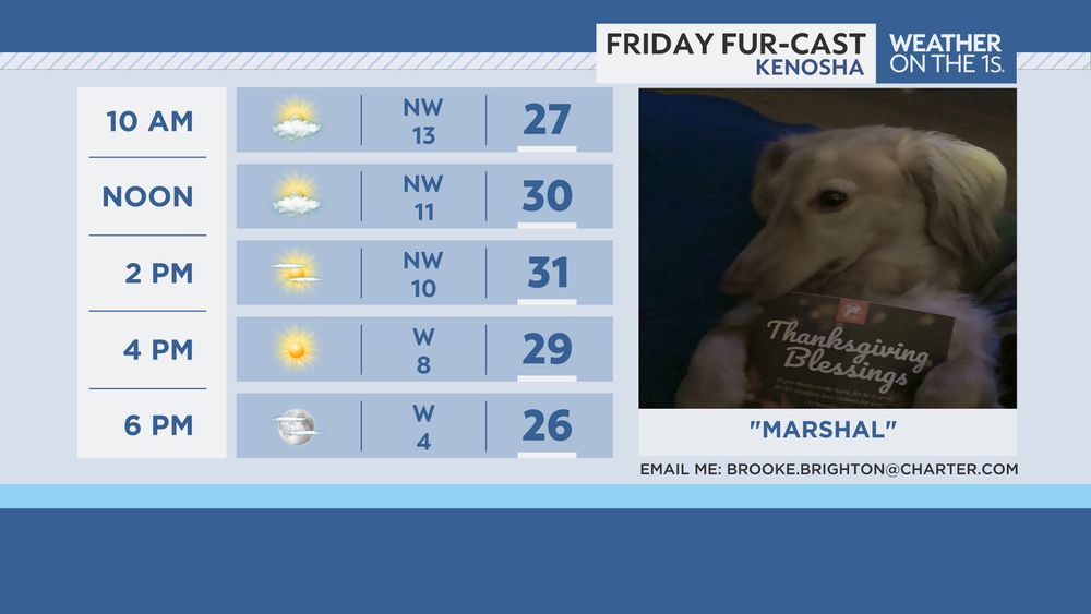
Our Spectrum News 1 Wisconsin #Furcast friend this Friday is "Marshal" from Kenosha (thanks to Spencer Montgomery for sharing). If you have any pictures of your pet, feel free to share it with me (make sure to include name & location) for your chance to be featured on-air. 🐶🐱🐭🐰🐦 #pets
November 28, 2025 at 1:33 PM
Hey #KansasCity! 👋 Rain return late Friday and continues into Saturday. We will see the chance for snow mixing in Saturday evening. Any precipitation clears out for Sunday, leaving behind even colder temperatures. #KCwx
November 28, 2025 at 12:00 PM
A system moves through Saturday, and depending on its track, that will determine where the heaviest #snow sets up. As of right now, southern #Wisconsin looks to be the target area, where we could see several inches of snow.

We'll provide more updates on-air and online heading into the #weekend.
November 27, 2025 at 3:29 PM
We'll see more sunshine mixing in for your #BlackFriday but it stays cold with highs in the 20s and wind chills in the teens. 🥶🛍️ #WIwx
November 27, 2025 at 2:22 PM
Reposted by Brooke Brighton
@brookebrighton.bsky.social

WETW3-West Allis-8A

Temp: 27
DP: 17
Wind Chill: 18
Wind: W at 7
Sky: BKN035

Previous 24 hours ending at 8A

MAX Temp: 33
MIN Temp: 27
Ave Temp: 30 -3.8

Precipitation: 0.01”
Snow: 0.1”
Snow on Ground: Trace
Frost Depth Sod: 0”
Frost Dpth Bare Gnd: 0”
November 27, 2025 at 2:12 PM
Starting off #Thanksgiving in #Wisconsin partly cloudy, but much of the afternoon will be mostly cloudy with a chance for a few flurries. Highs for most will be in the 20s, but wind chills will only be in the teens. It also remains breezy with a northwest wind at 15-25mph. #WIwx
November 27, 2025 at 1:11 PM
Chilly start to your #Thanksgiving in Wisconsin with morning lows in the 20s.
November 27, 2025 at 12:08 PM
#HappyThanksgiving Kansas City! 👋 We'll be sunny and chilly today, turning cloudy for #BlackFriday. #KCwx
November 27, 2025 at 11:30 AM
We'll be partly/mostly cloudy for #Thanksgiving, and it'll be cold with wind chills only in the teens. 🥶🦃
November 26, 2025 at 2:53 PM
We also have a Wind Advisory in place for much of the state Wednesday. Some locations could see #wind gusts up to 50mph. Gusty conditions combined with snow could reduce visibility at times. 🌬️ #WIwx
November 26, 2025 at 2:26 PM
Most of #Wisconsin is under some sort of winter weather alert Wednesday. Make sure to check road conditions throughout the day and allow extra time for travel. #WIwx
November 26, 2025 at 1:52 PM
Waking up to a winter wonderland in Manitowish Water Wednesday morning. Are you waking up to #snow? Send us your snow pictures! ❄️ #WIwx
November 26, 2025 at 1:05 PM
Helping you with your #travel plans...

If you can avoid traveling in far northern #Wisconsin, I'd recommend doing so as very low visibility is expected and snowy stretches are likely.

For the rest of the state, reduced visibility will be the main concern with #snow combined with #windy conditions.
November 26, 2025 at 12:10 PM
Waking up Wednesday morning with #snow circulating through #Wisconsin and morning lows in the 20s and 30s. #WIwx
November 26, 2025 at 11:12 AM
Hey #KansasCity! 👋 Feeling colder over the next few days with highs only in the low 40s. #KCwx
November 26, 2025 at 10:39 AM
Throughout Wednesday, share your #snow photos, videos and reports with us. We'll try to incorporate them during our Spectrum News 1 Wisconsin newscasts. ❄️ #WIwx
November 26, 2025 at 9:12 AM
Significant snow amounts will be seen in far northern Wisconsin Tue. PM - Thurs. AM (for some due to the help of lake-effect snow). Add in strong winds (gusts up to 45mph), visibility will likely be low at times, especially in northern Wisconsin. Also, get ready for colder temperatures to return.
November 25, 2025 at 3:35 PM
Reposted by Brooke Brighton
@brookebrighton.bsky.social

WETW3-West Allis-9A

Temp: 47
DP: 45
Wind Chill: 47
Wind: calm
Sky: FG OVC013

Previous 24 hours ending at 8A

MAX Temp: 51
MIN Temp: 39
Ave Temp: 45 +10.4

Precipitation: 0.02
Snow: 0.0”
Snow on Ground: 0”
Frost Depth Sod: 0”
Frost Dpth Bare Gnd: 0”
November 25, 2025 at 2:59 PM
Continue to share your weather photos with us through our Spectrum News app for your chance to be featured on-air and on our social media pages. 📸 #photography
November 25, 2025 at 1:46 PM
Today's featured Wisconsin photographer is John Road Photography who captured this cool shot at sunrise in Madison. 📸🌅 #photography
November 25, 2025 at 1:05 PM
Waking up to dense #fog across the Badger State Tuesday morning. Visibility will likely be impacted for that morning commute. 🌫️ #WIwx
November 25, 2025 at 12:04 PM
Hey #KansasCity! 👋 We'll be quiet, but colder over the next few days. #KCwx
November 25, 2025 at 11:33 AM