


@atreeo.bsky.social
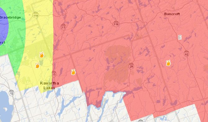
ECC has put out an info-graphic for Monday showing a high weather threat for the London corridor. Lines up with a couple of models showing localized amounts of 12-24 inches with a stationary squall line setting up in this corridor #onstorm

November 15, 2025 at 10:22 PM
ECC has put out an info-graphic for Monday showing a high weather threat for the London corridor. Lines up with a couple of models showing localized amounts of 12-24 inches with a stationary squall line setting up in this corridor #onstorm
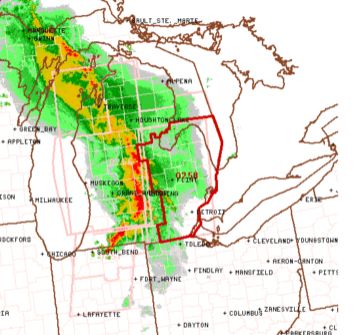
Chance for some potent severe weather tomorrow for Southern Ontario according to the HRRR. The line to watch is the one moving out of Michigan that Eastwards as it is coming out of an enhanced risk area issued by the SPC. #onstorm
June 17, 2025 at 3:51 PM
Chance for some potent severe weather tomorrow for Southern Ontario according to the HRRR. The line to watch is the one moving out of Michigan that Eastwards as it is coming out of an enhanced risk area issued by the SPC. #onstorm
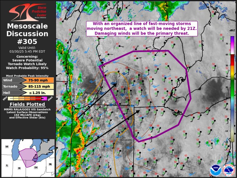
The Storm Prediction Center has issued a mesoscale discussion that includes deep Southwestern Ontario.
Find out more here www.spc.noaa.gov/products/md/...
#ONstorm
Find out more here www.spc.noaa.gov/products/md/...
#ONstorm
March 30, 2025 at 8:01 PM
The Storm Prediction Center has issued a mesoscale discussion that includes deep Southwestern Ontario.
Find out more here www.spc.noaa.gov/products/md/...
#ONstorm
Find out more here www.spc.noaa.gov/products/md/...
#ONstorm
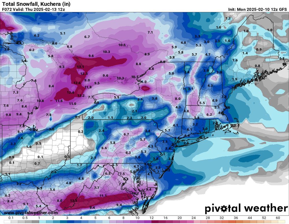
The models still seem to be in some disagreement with which areas are going to receive the most snow unfortunately but the GFS is showing a widespread snowfall event for a lot of places that haven't received a lot of snow this winter yet. The models are showing another snowstorm for this weekend.
February 10, 2025 at 5:05 PM
The models still seem to be in some disagreement with which areas are going to receive the most snow unfortunately but the GFS is showing a widespread snowfall event for a lot of places that haven't received a lot of snow this winter yet. The models are showing another snowstorm for this weekend.