


Ashley Brauweiler
@abrauweiler.bsky.social
CBC Newfoundland and Labrador Meteorologist
Reposted by Ashley Brauweiler
Reposted by Ashley Brauweiler

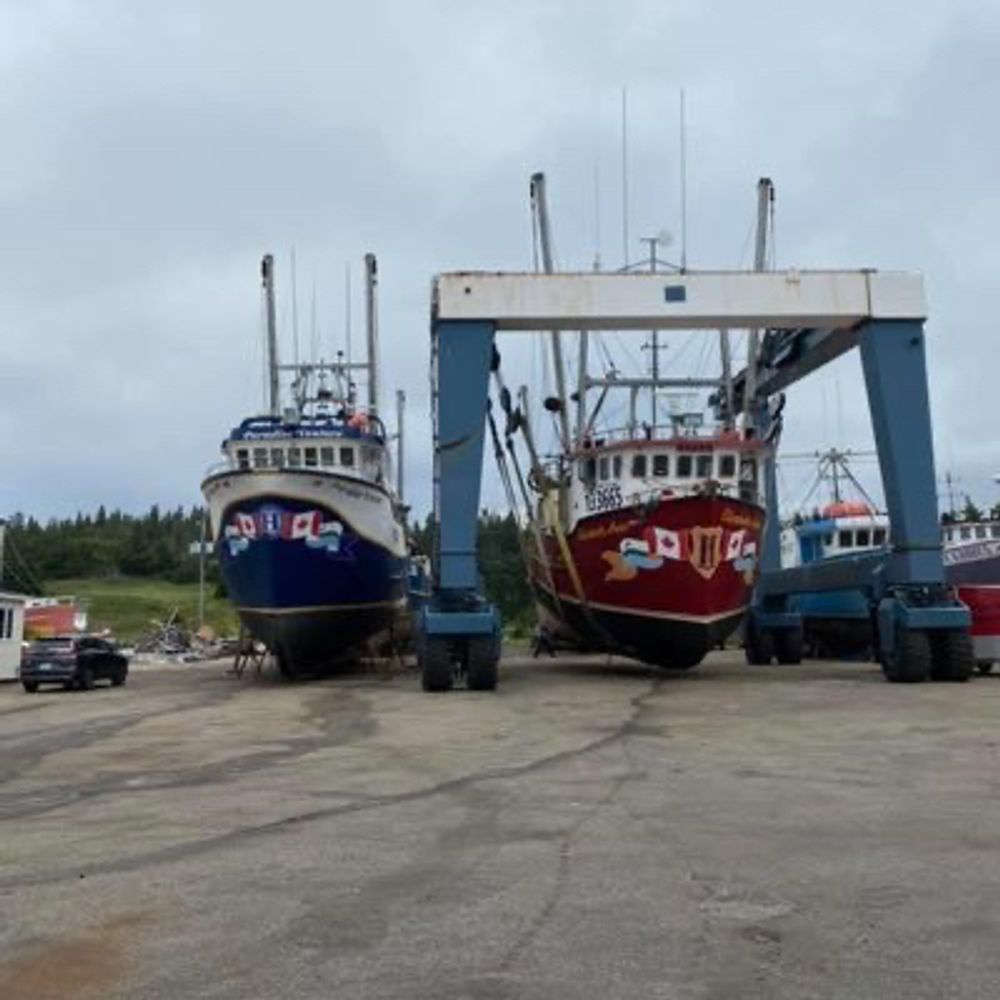
Some rainy #nlwx in central & eastern Newfoundland over the past 48 hours 🌧️ — but it appears the area that needed the most got the least. A decent soaking for parts of Central though.

August 20, 2025 at 12:34 PM
Some rainy #nlwx in central & eastern Newfoundland over the past 48 hours 🌧️ — but it appears the area that needed the most got the least. A decent soaking for parts of Central though.
Reposted by Ashley Brauweiler
Front bringing showers/t-showers to the island. Rainfall (mm) thru 11:30 am:
28.1 (La Scie);
26.6 (Westport);
17.8 (Humber Village);
17.5 (Burgeo Hwy);
16.6 (Birchy Narrows);
12.5 (Stephenville);
11.9 (Corner Brook);
9.0 (PAB);
6.1 (Burgeo);
2.8 (GFW).
Gander & east up next. #nlwx
28.1 (La Scie);
26.6 (Westport);
17.8 (Humber Village);
17.5 (Burgeo Hwy);
16.6 (Birchy Narrows);
12.5 (Stephenville);
11.9 (Corner Brook);
9.0 (PAB);
6.1 (Burgeo);
2.8 (GFW).
Gander & east up next. #nlwx

August 15, 2025 at 2:09 PM
Front bringing showers/t-showers to the island. Rainfall (mm) thru 11:30 am:
28.1 (La Scie);
26.6 (Westport);
17.8 (Humber Village);
17.5 (Burgeo Hwy);
16.6 (Birchy Narrows);
12.5 (Stephenville);
11.9 (Corner Brook);
9.0 (PAB);
6.1 (Burgeo);
2.8 (GFW).
Gander & east up next. #nlwx
28.1 (La Scie);
26.6 (Westport);
17.8 (Humber Village);
17.5 (Burgeo Hwy);
16.6 (Birchy Narrows);
12.5 (Stephenville);
11.9 (Corner Brook);
9.0 (PAB);
6.1 (Burgeo);
2.8 (GFW).
Gander & east up next. #nlwx
Reposted by Ashley Brauweiler
Last day firmly under heat dome brings new AUGUST monthly extreme for #Labrador. Official high 36.5°C at Goose Bay #YYR breaks old rec 35.3°C held at same location since Aug 8, 1996 & tied Aug 11, 2025. 📈
Unofficial 37.7°C at NW River.
Closing day of widespread 30s for #NLwx. 🌡️
Unofficial 37.7°C at NW River.
Closing day of widespread 30s for #NLwx. 🌡️

August 14, 2025 at 12:12 AM
Reposted by Ashley Brauweiler
In addition to all the highs yesterday, some record warm minimums.
Low 20.1°C at #Cartwright sets new ALL TIME record; beating 19.5°C (Aug 13, 2021).
Low 21.4°C at Goose Bay #YYR sets new AUGUST record; beating 21.1°C (Aug 7, 1996).
Summary of highs here:
weather.gc.ca/warnings/wea... #nlwx
Low 20.1°C at #Cartwright sets new ALL TIME record; beating 19.5°C (Aug 13, 2021).
Low 21.4°C at Goose Bay #YYR sets new AUGUST record; beating 21.1°C (Aug 7, 1996).
Summary of highs here:
weather.gc.ca/warnings/wea... #nlwx


August 14, 2025 at 12:26 PM
In addition to all the highs yesterday, some record warm minimums.
Low 20.1°C at #Cartwright sets new ALL TIME record; beating 19.5°C (Aug 13, 2021).
Low 21.4°C at Goose Bay #YYR sets new AUGUST record; beating 21.1°C (Aug 7, 1996).
Summary of highs here:
weather.gc.ca/warnings/wea... #nlwx
Low 20.1°C at #Cartwright sets new ALL TIME record; beating 19.5°C (Aug 13, 2021).
Low 21.4°C at Goose Bay #YYR sets new AUGUST record; beating 21.1°C (Aug 7, 1996).
Summary of highs here:
weather.gc.ca/warnings/wea... #nlwx
Reposted by Ashley Brauweiler
Can now also add #Bonavista:
High 30.4°C, breaking old August monthly record of 30.1°C set Aug 4, 1979.
#nlwx
High 30.4°C, breaking old August monthly record of 30.1°C set Aug 4, 1979.
#nlwx
=NEW AUGUST MONTHLY RECORDS=
34.6°C at Gander #YQX (old 33.3/Aug 22, 1976);
34.3°C at Deer Lake #YDF (old 33.3/Aug 22, 1976);
33.5°C at La Scie (old 31.5/Aug 11, 2025);
3rd warmest Tmax all-time for YQX. #nlwx
34.6°C at Gander #YQX (old 33.3/Aug 22, 1976);
34.3°C at Deer Lake #YDF (old 33.3/Aug 22, 1976);
33.5°C at La Scie (old 31.5/Aug 11, 2025);
3rd warmest Tmax all-time for YQX. #nlwx
=NEW ALL-TIME STATION RECORDS=
High 36.7°C at #Badger today broke the location's previous record of 34.9°C set Jul 17, 2025 and 34.9°C+ on Jun 14, 1999. Data since 1956.
High 34.9°C at #Twillingate broke location's previous record of 34.4°C set Jul 8, 1952. Data since 1950.
#nlwx
High 36.7°C at #Badger today broke the location's previous record of 34.9°C set Jul 17, 2025 and 34.9°C+ on Jun 14, 1999. Data since 1956.
High 34.9°C at #Twillingate broke location's previous record of 34.4°C set Jul 8, 1952. Data since 1950.
#nlwx
August 12, 2025 at 8:22 PM
Can now also add #Bonavista:
High 30.4°C, breaking old August monthly record of 30.1°C set Aug 4, 1979.
#nlwx
High 30.4°C, breaking old August monthly record of 30.1°C set Aug 4, 1979.
#nlwx
Reposted by Ashley Brauweiler
=ALL TIME NL HUMIDEX RECORD=
Humidex 43 in Twillingate at 2:30 pm makes for highest reliable Humidex value ever officially measured in NL (excluding a couple suspect values in the 1970s in Labrador).
Prev highest reliable: 42 (Terra Nova, Sep 10, 2001).
#nlwx
Humidex 43 in Twillingate at 2:30 pm makes for highest reliable Humidex value ever officially measured in NL (excluding a couple suspect values in the 1970s in Labrador).
Prev highest reliable: 42 (Terra Nova, Sep 10, 2001).
#nlwx
August 12, 2025 at 6:05 PM
=ALL TIME NL HUMIDEX RECORD=
Humidex 43 in Twillingate at 2:30 pm makes for highest reliable Humidex value ever officially measured in NL (excluding a couple suspect values in the 1970s in Labrador).
Prev highest reliable: 42 (Terra Nova, Sep 10, 2001).
#nlwx
Humidex 43 in Twillingate at 2:30 pm makes for highest reliable Humidex value ever officially measured in NL (excluding a couple suspect values in the 1970s in Labrador).
Prev highest reliable: 42 (Terra Nova, Sep 10, 2001).
#nlwx
Can't beat a little bit of glitter and blue sky.
@abrauweiler.bsky.social Freezing rain this past weekend left Cartwright sparkling!
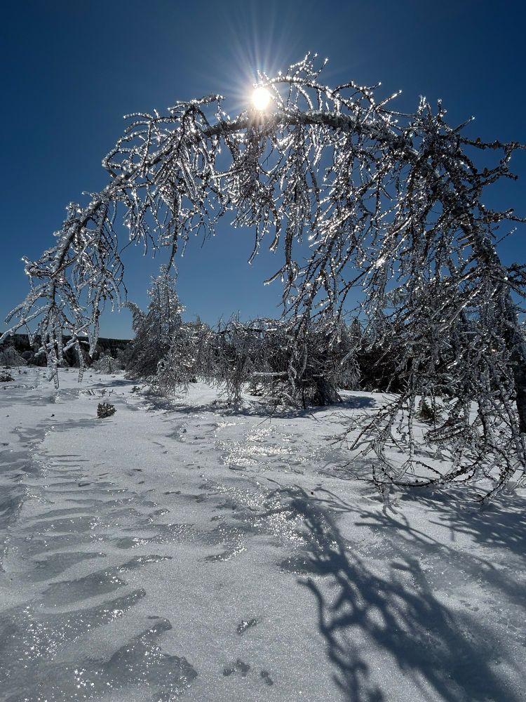
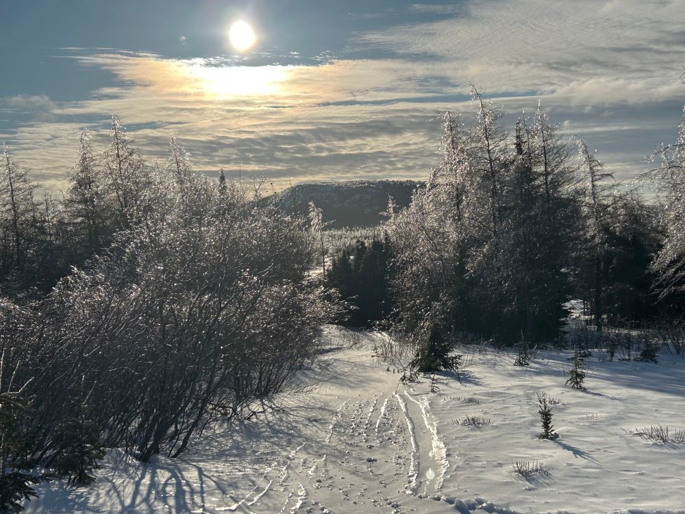
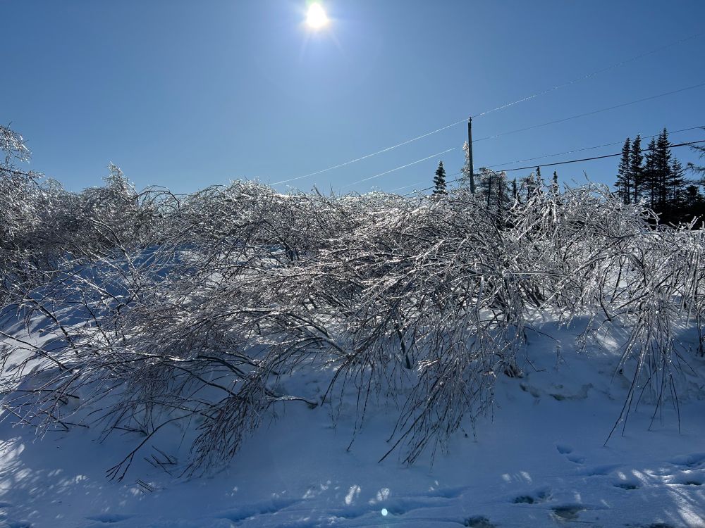
March 24, 2025 at 8:06 PM
Can't beat a little bit of glitter and blue sky.
Wow!
March 21, 2025 at 9:08 PM
Wow!
Reposted by Ashley Brauweiler

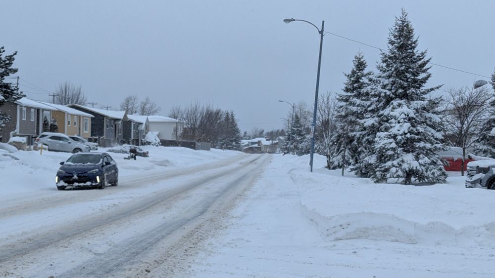
Snow in Paradise as of 9:30pm. 29.9 cm and 16.6 mm water equivalent from my heated rain cone (1.3 cm accumulation in the last hour). Snowboard cleaned off. No more ruler pictures. #NLwx

February 22, 2025 at 1:02 AM
Snow in Paradise as of 9:30pm. 29.9 cm and 16.6 mm water equivalent from my heated rain cone (1.3 cm accumulation in the last hour). Snowboard cleaned off. No more ruler pictures. #NLwx
Reposted by Ashley Brauweiler
Snow in Paradise as of 2:30pm. 8.4 cm and 2.4 mm water equivalent from my heated rain cone (3.1 cm accumulation in the last hour). #NLwx

February 21, 2025 at 6:00 PM
Snow in Paradise as of 2:30pm. 8.4 cm and 2.4 mm water equivalent from my heated rain cone (3.1 cm accumulation in the last hour). #NLwx
ECCC upgraded to a winter storm warning for the northeast Avalon.
The snow is just starting for the southern Avalon and will continue to spread north over the next few hours.
Ashley
The snow is just starting for the southern Avalon and will continue to spread north over the next few hours.
Ashley

February 21, 2025 at 12:19 PM
ECCC upgraded to a winter storm warning for the northeast Avalon.
The snow is just starting for the southern Avalon and will continue to spread north over the next few hours.
Ashley
The snow is just starting for the southern Avalon and will continue to spread north over the next few hours.
Ashley
Reposted by Ashley Brauweiler
Prelim snowfall totals from data collected so far. Some may have received small additional accums.
41.1 cm (St. John's East);
41 cm (St. John's #YYT);
38.5 cm (CBS);
38.4 cm (Paradise);
36 cm (Victoria, CBN);
28 cm (Brigus);
28 cm (Bay Roberts);
26 cm (Bonavista);
24 cm (St. Lawrence).
#nlwx
41.1 cm (St. John's East);
41 cm (St. John's #YYT);
38.5 cm (CBS);
38.4 cm (Paradise);
36 cm (Victoria, CBN);
28 cm (Brigus);
28 cm (Bay Roberts);
26 cm (Bonavista);
24 cm (St. Lawrence).
#nlwx
February 10, 2025 at 7:09 PM
February 10, 2025 at 11:20 AM
35 cm reported at St. John’s airport. Snow is starting to wind down but the strong winds will continue for the next few hours.
Northwest winds gusting near 70 km/h will continue all day. #nlwx
Northwest winds gusting near 70 km/h will continue all day. #nlwx
February 10, 2025 at 10:15 AM
35 cm reported at St. John’s airport. Snow is starting to wind down but the strong winds will continue for the next few hours.
Northwest winds gusting near 70 km/h will continue all day. #nlwx
Northwest winds gusting near 70 km/h will continue all day. #nlwx
Our first blizzard warning of the year is in place for the Avalon.
20-35+ cm for the Avalon tapering to flurries Monday AM and early afternoon. 10-20 cm for the rest of eastern Newfoundland.
NE then NW gusts between 80-110 km/h after midnight through noon. The strongest winds between 3-9 am.
20-35+ cm for the Avalon tapering to flurries Monday AM and early afternoon. 10-20 cm for the rest of eastern Newfoundland.
NE then NW gusts between 80-110 km/h after midnight through noon. The strongest winds between 3-9 am.


February 9, 2025 at 8:46 PM
Our first blizzard warning of the year is in place for the Avalon.
20-35+ cm for the Avalon tapering to flurries Monday AM and early afternoon. 10-20 cm for the rest of eastern Newfoundland.
NE then NW gusts between 80-110 km/h after midnight through noon. The strongest winds between 3-9 am.
20-35+ cm for the Avalon tapering to flurries Monday AM and early afternoon. 10-20 cm for the rest of eastern Newfoundland.
NE then NW gusts between 80-110 km/h after midnight through noon. The strongest winds between 3-9 am.
No surprise but January was well above normal across the province which led to more rain and less snow right across the board.
Happy Valley-Goose Bay tied for their warmest Jan on record and most were within their top 5, except PAB and Stephenville.
#nlwx
Happy Valley-Goose Bay tied for their warmest Jan on record and most were within their top 5, except PAB and Stephenville.
#nlwx

February 6, 2025 at 3:01 PM
No surprise but January was well above normal across the province which led to more rain and less snow right across the board.
Happy Valley-Goose Bay tied for their warmest Jan on record and most were within their top 5, except PAB and Stephenville.
#nlwx
Happy Valley-Goose Bay tied for their warmest Jan on record and most were within their top 5, except PAB and Stephenville.
#nlwx
Reposted by Ashley Brauweiler
Almost the end of January, but finally the first 'decent' snowfall of the season for central and eastern parts of the island. Snow-to-liquid ratios of 15 to 20+ to 1 certainly helped to give the accumulations an extra boost in Central! #nlwx

January 30, 2025 at 8:11 PM
Almost the end of January, but finally the first 'decent' snowfall of the season for central and eastern parts of the island. Snow-to-liquid ratios of 15 to 20+ to 1 certainly helped to give the accumulations an extra boost in Central! #nlwx
Reposted by Ashley Brauweiler
Picked up another 5.5 cm since 7am, bringing #GanderWest snowfall to 23 cm thru 1:30 pm. Water equivalent 14.8 mm.
Still snowing lightly. Will post numbers from around the region later this afternoon. #nlwx
Still snowing lightly. Will post numbers from around the region later this afternoon. #nlwx
January 30, 2025 at 5:09 PM
Picked up another 5.5 cm since 7am, bringing #GanderWest snowfall to 23 cm thru 1:30 pm. Water equivalent 14.8 mm.
Still snowing lightly. Will post numbers from around the region later this afternoon. #nlwx
Still snowing lightly. Will post numbers from around the region later this afternoon. #nlwx
Wow.
Today, Jan 8, marks the 5th consecutive day where the snow depth is just a trace at Goose Bay #YYR.
Daily snow depth records at YYR go back to 1955, but prior to 2025 there has never been a date in January with less than 2 cm of snow on the ground.
www.gov.nl.ca/ti/roads/cam... #nlwx
Daily snow depth records at YYR go back to 1955, but prior to 2025 there has never been a date in January with less than 2 cm of snow on the ground.
www.gov.nl.ca/ti/roads/cam... #nlwx

January 8, 2025 at 6:38 PM
Wow.
